Centro diurno Alimarket
Centro diurno Alimarket is a building in Bolzano/Bozen, South Tyrol, Trentino-Alto Adige which is located on Via Piero Gobetti - Piero-Gobetti-Straße. Centro diurno Alimarket is situated nearby to the motorhome stopover Area camper Bolzano, as well as near the government office Centro Revisione Veicoli - Landesprüfstelle für Fahrzeuge.| Tap on a place to explore it |
Places of Interest Nearby
Highlights include Sparkasse Arena and Cemetery of Bozen.
Sparkasse Arena
Stadium

Photo: Boboseiptu, CC BY 2.5.
The Sparkasse Arena, formerly called PalaOnda or Eiswelle, is an indoor sports arena in Bolzano, Italy. It was built to host the 1994 Men's World Ice Hockey Championships along with Forum di Assago and has a capacity of 7,200. Sparkasse Arena is situated 560 metres southwest of Centro diurno Alimarket.
Cemetery of Bozen
Cemetery
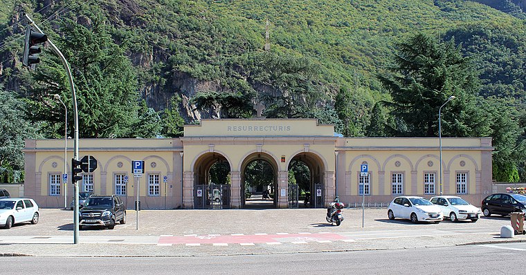
Photo: ManfredK, CC BY-SA 4.0.
Cemetery of Bozen is situated 290 metres east of Centro diurno Alimarket.
Haselburg
Castle
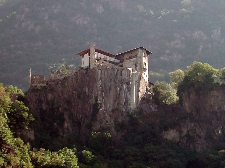
Photo: Cepaea, CC BY-SA 3.0.
Haselburg is a castle, which is situated 660 metres northeast of Centro diurno Alimarket.
Places in the Area
Nearby places include San Giacomo and Seit.

Bolzano

Photo: Italo-Europeo, CC BY-SA 3.0.
Bolzano or Bozen, is the capital city of South Tyrol, the German-speaking region in the northern part of Italy. Bolzano is the largest city in the region.
Centro diurno Alimarket
- Type: Health care
- Address: Via Piero Gobetti - Piero-Gobetti-Straße 8, Bolzano - Bozen, 39100
- Category: building
- Location: Bolzano/Bozen, South Tyrol, Trentino-Alto Adige, Northeast Italy, Italy, Europe
- View on OpenStreetMap
Latitude
46.47453° or 46° 28′ 28″ northLongitude
11.33566° or 11° 20′ 8″ eastOperator
Italian Red CrossOpen location code
8FRHF8FP+R7OpenStreetMap ID
way 459191910OpenStreetMap feature
building=yesOpenStreetMap feature
healthcare=counselling
This page is based on OpenStreetMap, Wikidata, and Wikimedia Commons.
We’d love your help improving our open data sources. Thank you for contributing.
Satellite Map
Discover Centro diurno Alimarket from above in high-definition satellite imagery.
Notable Places Nearby
Highlights include Area camper Bolzano and Centro Revisione Veicoli - Landesprüfstelle für Fahrzeuge.
Nearby Places
Explore places such as Centro Prima Accoglienza and Liceo economico sociale ‘Sandro Pertini’.
South Tyrol: Must-Visit Destinations
Delve into Bolzano, Brixen, Merano, and Bruneck.
Curious Places to Discover
Uncover intriguing places from every corner of the globe.
About Mapcarta. Data © OpenStreetMap contributors and available under the Open Database License". Text is available under the CC BY-SA 4.0 license, except for photos, directions, and the map. Photo: Benreis, CC BY 3.0.