Campo de Rugby del Centro Español de Rancagua
Campo de Rugby del Centro Español de Rancagua is a pitch in Rancagua, Cachapoal Province, O’Higgins Region. Campo de Rugby del Centro Español de Rancagua is situated nearby to the park Parque María Luisa, as well as near the cemetery Cementerio Parque del Sendero.| Tap on a place to explore it |
Places of Interest Nearby
Highlights include Rancagua Regional Hospital and Centro Deportivo Patricio Mekis.
Rancagua Regional Hospital
Hospital
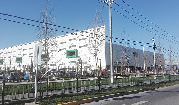
Photo: Warko, CC BY-SA 4.0.
Rancagua Regional Hospital is situated 1¼ km west of Campo de Rugby del Centro Español de Rancagua.
Centro Deportivo Patricio Mekis
Sports venue

Photo: Benjaminpvera, CC BY-SA 4.0.
Centro Deportivo Patricio Mekis is a sports venue, which is situated 730 metres northeast of Campo de Rugby del Centro Español de Rancagua.
Colegio Interamericano de Rancagua
School
Colegio Interamericano is a Chilean high school located in Rancagua, Cachapoal Province, Chile. Colegio Interamericano de Rancagua is situated 610 metres north of Campo de Rugby del Centro Español de Rancagua.
Places in the Area
Nearby places include Olivar and Chancón.
Olivar
Village

Photo: Wikimedia, CC BY-SA 3.0.
Olivar is a commune in Chile, located in the O'Higgins Region, 10 km south of Rancagua, and administered by the municipality of Olivar. The main economic activities range from agriculture and food production, especially apples for exportation. Olivar is situated 8 km southwest of Campo de Rugby del Centro Español de Rancagua.
Chancón
Hamlet

Photo: R.A.T.P., CC BY-SA 3.0.
Chancón is a hamlet, which is situated 8 km northwest of Campo de Rugby del Centro Español de Rancagua.
Los Lirios
Village

Photo: Aeveraal, CC BY-SA 3.0.
Los Lirios is a village, which is situated 8 km southwest of Campo de Rugby del Centro Español de Rancagua.
Campo de Rugby del Centro Español de Rancagua
- Type: Pitch
- Categories: rugby, recreation area, and sports location
- Location: Rancagua, Cachapoal Province, O’Higgins Region, Central Chile, Chile, South America
- View on OpenStreetMap
Latitude
-34.15899° or 34° 9′ 32″ southLongitude
-70.75362° or 70° 45′ 13″ westOpen location code
47QFR6RW+CHOpenStreetMap ID
way 464553306OpenStreetMap feature
leisure=pitchOpenStreetMap feature
sport=rugby_union
This page is based on OpenStreetMap, Wikidata, and Wikimedia Commons.
We’d love your help improving our open data sources. Thank you for contributing.
Satellite Map
Discover Campo de Rugby del Centro Español de Rancagua from above in high-definition satellite imagery.
Notable Places Nearby
Highlights include Parque María Luisa and Centro Español de Rancagua.
Nearby Places
Explore places such as Cafeteria del Centro Español de Rancagua and Otro.
Central Chile: Must-Visit Destinations
Delve into Santiago, Valparaíso, Pichilemu, and Viña del Mar.
Curious Pitches to Discover
Uncover intriguing pitches from every corner of the globe.
About Mapcarta. Data © OpenStreetMap contributors and available under the Open Database License". Text is available under the CC BY-SA 4.0 license, except for photos, directions, and the map. Photo: Marco Antonio Correa Flores, CC BY-SA 4.0.