Ultraflex Fitness
Ultraflex Fitness is a health club in Los Angeles, Southern California, California. Ultraflex Fitness is situated nearby to Kwan Yin Meditation Temple, as well as near the health club Tae Kwon Do.| Tap on a place to explore it |
Places of Interest Nearby
Highlights include Aztec Hotel and Monrovia station.
Aztec Hotel
Hotel

Photo: Wikimedia, CC BY-SA 2.0.
The Aztec Hotel is a historical landmark building in Monrovia, in the San Gabriel Valley, California. The hotel is an example of Mayan Revival architecture still in existence. Aztec Hotel is situated 670 feet west of Ultraflex Fitness.
Monrovia station
Railway station
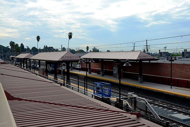
Photo: Wikimedia, Public domain.
Monrovia station is an at-grade light rail station on the A Line of the Los Angeles Metro Rail system. It is located at the intersection of Duarte Road and Myrtle Avenue in Monrovia, California, after which the station is named. Monrovia station is situated 1¼ miles south of Ultraflex Fitness.
Arcadia station
Railway station

Photo: Wikimedia, Public domain.
Arcadia station is an at-grade light rail station on the A Line of the Los Angeles Metro Rail system. It is located at the intersection of 1st Avenue and Santa Clara Street in Arcadia, California, after which the station is named. Arcadia station is situated 1½ miles west of Ultraflex Fitness.
Places in the Area
Nearby places include Monrovia and Duarte.
Monrovia
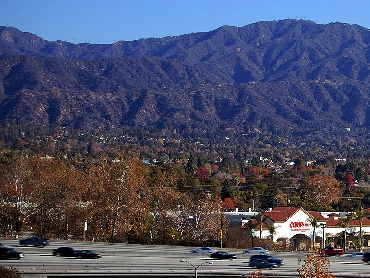
Photo: Wikimedia, CC BY-SA 3.0.
Monrovia is a city in the foothills of the San Gabriel Mountains in the San Gabriel Valley of Los Angeles County, California, United States. Monrovia is the fourth-oldest general-law city in Los Angeles County and the L.A. Basin.
Duarte
Town
Photo: Platinummedia, CC BY-SA 4.0.
Duarte is a city in Los Angeles County, California, United States. As of the 2020 census, the city population was 21,727. Duarte is located on historic U.S. Route 66, which today follows Huntington Drive through the middle of the city. Duarte is situated 1½ miles southeast of Ultraflex Fitness.
Bradbury
Village
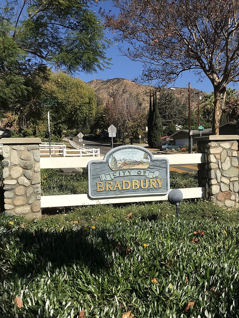
Photo: Fruitianslip, CC BY-SA 4.0.
Bradbury is a city in the San Gabriel Valley region of Los Angeles County, California, United States. It is located in the foothills of the San Gabriel Mountains below Angeles National Forest. Bradbury is situated 2 miles east of Ultraflex Fitness.
Ultraflex Fitness
- Type: Health club
- Categories: building, recreation area, and sports location
- Location: Los Angeles, Southern California, California, United States, North America
- View on OpenStreetMap
Latitude
34.15109° or 34° 9′ 4″ northLongitude
-118.00366° or 118° 0′ 13″ westElevation
591 feet (180 metres)Inception
1964Height
23 feet (6.9 metres)Open location code
85635X2W+CGOpenStreetMap ID
way 471457600OpenStreetMap feature
building=yesOpenStreetMap feature
leisure=fitness_centre
This page is based on OpenStreetMap, Wikidata, and Wikimedia Commons.
We’d love your help improving our open data sources. Thank you for contributing.
Satellite Map
Discover Ultraflex Fitness from above in high-definition satellite imagery.
Notable Places Nearby
Highlights include Kwan Yin Meditation Temple and Tae Kwon Do.
Nearby Places
Explore places such as The Copper Lamp and T-Burger.
Los Angeles: Must-Visit Destinations
Delve into Hollywood, San Gabriel Valley, San Fernando Valley, and Long Beach.
Curious Health Clubs to Discover
Uncover intriguing health clubs from every corner of the globe.
About Mapcarta. Data © OpenStreetMap contributors and available under the Open Database License". Text is available under the CC BY-SA 4.0 license, except for photos, directions, and the map. Photo: Mfield, CC BY-SA 3.0.