De Meergronden
De Meergronden is a school in Almere, Flevoland which is located on Marktgracht. De Meergronden is situated nearby to the bridge Bivakbrug, as well as near Schoolbrug.| Tap on a place to explore it |
- Email: info@meergronden.asg.nl
- Type: School
- Description: school in Almere, Netherlands
- Also known as: “Scholengemeenschap De Meergronden”
- Address: Marktgracht 65, Almere, 1353AL
Places of Interest Nearby
Highlights include Almere Muziekwijk railway station and Kromslootpark.
Almere Muziekwijk railway station
Railway station
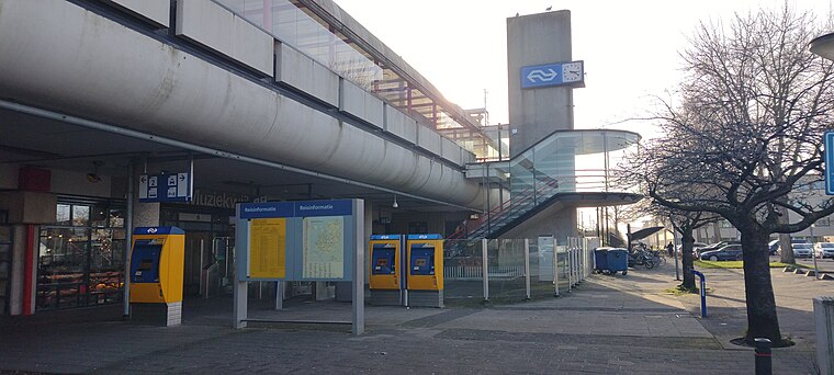
Photo: Sneeuwvlakte, CC BY-SA 4.0.
Almere Muziekwijk is a railway station in Almere, The Netherlands. It is located approximately 20 km east of Amsterdam. It is on the Weesp–Lelystad railway. Almere Muziekwijk railway station is situated 4 km northwest of De Meergronden.
Kromslootpark
Nature reserve
 Kromslootpark is a nature reserve, which is situated 3 km west of De Meergronden.
Flevoziekenhuis
Hospital

Photo: Mark Ahsmann, CC BY-SA 4.0.
Flevoziekenhuis is a hospital, which is situated 3½ km north of De Meergronden.
Places in the Area
Nearby places include Almere Haven and Almere Stad.
Almere Haven
Suburb

Photo: Ilonamay, CC BY-SA 3.0.
Almere Haven is the oldest borough of Almere. Although Almere Haven does not have its own railway station, it is well-connected to Amsterdam and the rest of Almere by a good bus rapid transit system.
Almere Stad
Suburb

Photo: Ellywa, CC BY-SA 3.0.
Almere Stad is a district of the city Almere in the Dutch province Flevoland. The first houses in Almere Stad were finished in 1980. Nowadays there are several residential areas, offices, industrial areas, parks, and a lake. Almere Stad is situated 4 km north of De Meergronden.
Almere Poort
Suburb
Almere Gate is a borough of Almere, Netherlands. It is the newest part of what is a new city itself, with the first building completed only in 2005. Although Almere is a planned city, Almere Poort was not in the original city plans, but is rather a result… Almere Poort is situated 4½ km west of De Meergronden.
De Meergronden
- Category: education
- Location: Almere, Flevoland, Western Netherlands, Netherlands, Benelux, Europe
- View on OpenStreetMap
Latitude
52.33636° or 52° 20′ 11″ northLongitude
5.21669° or 5° 13′ 0″ eastOperator
Almeerse Scholen GroepOpen location code
9F4786P8+GMOpenStreetMap ID
way 475962915OpenStreetMap feature
amenity=schoolWikidata ID
Q2265872
This page is based on OpenStreetMap, Wikidata, and Wikimedia Commons.
We’d love your help improving our open data sources. Thank you for contributing.
Satellite Map
Discover De Meergronden from above in high-definition satellite imagery.
In Other Languages
“De Meergronden” goes by many names.
- Dutch: “OSG de Meergronden”
Notable Places Nearby
Highlights include Bivakbrug and Schoolbrug.
Nearby Places
Explore places such as Bicycle parking residents ‘De Hulk’ and Parkeerplaats Haak.
Flevoland: Must-Visit Destinations
Delve into Lelystad, Dronten, Urk, and Noordoostpolder.
Curious Schools to Discover
Uncover intriguing schools from every corner of the globe.
About Mapcarta. Data © OpenStreetMap contributors and available under the Open Database License". Text is available under the CC BY-SA 4.0 license, except for photos, directions, and the map. Photo: Al1 73, CC BY-SA 3.0.