T.C. de Burght
T.C. de Burght is a pitch in Maastricht, South Limburg, Limburg. T.C. de Burght is situated nearby to the church Antonius van Paduakerk, as well as near Maastricht public library, service point Heer.| Tap on a place to explore it |
Places of Interest Nearby
Highlights include Antonius van Paduakerk and Maastricht Railway Station.
Antonius van Paduakerk
Church

Photo: Wikimedia, Public domain.
Antonius van Paduakerk is a church, which is situated 330 metres northeast of T.C. de Burght.
Maastricht Railway Station
Railway station

Photo: AarClaij, CC BY-SA 4.0.
Maastricht railway station is located in Maastricht in Limburg, Netherlands. It is the main railway station in Limburg's capital city. It is the southern terminus of the Alkmaar–Maastricht intercity service by NS. Maastricht Railway Station is situated 1¼ km west of T.C. de Burght.
Bonnefantenmuseum
Museum
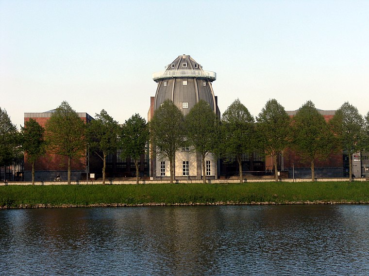
Photo: Mark Ahsmann, CC BY-SA 3.0.
The Bonnefanten Museum is a museum of historic, modern and contemporary art in Maastricht, Netherlands. Bonnefantenmuseum is situated 1½ km west of T.C. de Burght.
Places in the Area
Nearby places include Heer and Wyck.
Heer
Neighborhood
Heer is a neighbourhood of Maastricht, in the Dutch province of Limburg. Heer is a former municipality and village, incorporated into Maastricht in 1970 and, until 1828, this municipality was called "Heer en Keer".
Wyck
Neighborhood
Wyck is a neighbourhood in Maastricht, Netherlands, comprising the eastern bank of the Meuse in the city's historic centre.

T.C. de Burght
- Type: Pitch
- Categories: tennis, recreation area, and sports location
- Location: Maastricht, South Limburg, Limburg, Southern Netherlands, Netherlands, Benelux, Europe
- View on OpenStreetMap
Latitude
50.84617° or 50° 50′ 46″ northLongitude
5.72096° or 5° 43′ 16″ eastOpen location code
9F27RPWC+F9OpenStreetMap ID
way 4775320OpenStreetMap feature
leisure=pitchOpenStreetMap feature
sport=tennis
This page is based on OpenStreetMap, Wikidata, and Wikimedia Commons.
We’d love your help improving our open data sources. Thank you for contributing.
Satellite Map
Discover T.C. de Burght from above in high-definition satellite imagery.
Notable Places Nearby
Highlights include Maastricht public library, service point Heer and Anytime Fitness.
Nearby Places
Explore places such as Sibemaweg and Novotel Maastricht.
South Limburg: Must-Visit Destinations
Delve into Heerlen, Kerkrade, Valkenburg aan de Geul, and Vaals.
Curious Pitches to Discover
Uncover intriguing pitches from every corner of the globe.
About Mapcarta. Data © OpenStreetMap contributors and available under the Open Database License". Text is available under the CC BY-SA 4.0 license, except for photos, directions, and the map. Photo: Bodoklecksel, CC BY-SA 3.0.