Edificio técnico ADIF
Edificio técnico ADIF is an office in Elche, Costa Blanca, Valencian Community. Edificio técnico ADIF is situated nearby to the railway station Elche AV station, as well as near the pitch Pádel 360.| Tap on a place to explore it |
Places of Interest Nearby
Highlights include Elche AV station and Crevillente train station.
Elche AV station
Railway station
 Elche AV station is a railway station, which is situated 230 metres southwest of Edificio técnico ADIF.
Crevillente train station
Railway station
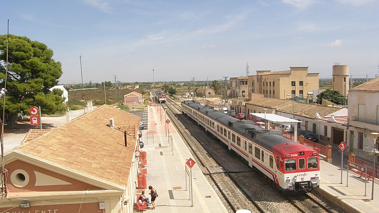
Photo: Shaku-kun, CC BY-SA 3.0.
Crevillente train station is a railway station, which is situated 3 km southwest of Edificio técnico ADIF.
Town hall of Crevillent
Town hall

Photo: Idroxide, CC BY-SA 4.0.
Town hall of Crevillent is situated 4 km west of Edificio técnico ADIF.
Places in the Area
Nearby places include Crevillent and el Raval de Sant Joan.
Crevillent
Town

Photo: Quesada, CC BY-SA 3.0.
Crevillent is a town and municipality located in the Alicante province, part of the Valencian Community, Spain. It is situated in the comarca of Baix Vinalopó, and lies at the foot of the hill range known locally as Serra de Crevillent. Crevillent is situated 4 km west of Edificio técnico ADIF.
el Raval de Sant Joan
Neighborhood

Photo: Espencat, Public domain.
el Raval de Sant Joan is a neighborhood, which is situated 6 km east of Edificio técnico ADIF.
El Realengo
Hamlet

Photo: Alejandrommcc, CC BY-SA 3.0.
El Realengo is a hamlet, which is situated 7 km southwest of Edificio técnico ADIF.
Edificio técnico ADIF
- Type: Office
- Category: building
- Location: Elche, Costa Blanca, Alicante, Valencian Community, Eastern Spain, Spain, Iberia, Europe
- View on OpenStreetMap
Latitude
38.24698° or 38° 14′ 49″ northLongitude
-0.76509° or 0° 45′ 54″ westOpen location code
8CCX66WM+QXOpenStreetMap ID
way 482702394OpenStreetMap feature
building=yesOpenStreetMap feature
office=yes
This page is based on OpenStreetMap, Wikidata, and Wikimedia Commons.
We’d love your help improving our open data sources. Thank you for contributing.
Satellite Map
Discover Edificio técnico ADIF from above in high-definition satellite imagery.
Places with the Same Name
Discover other places named “Edificio técnico ADIF”.
Notable Places Nearby
Highlights include Pádel 360 and Centro Cívico Matola La Cueva.
Nearby Places
Explore places such as Elche / Elx AV and Elx, Estació AVE Crevillent - Matola.
Costa Blanca: Must-Visit Destinations
Delve into Alicante, Benidorm, Torrevieja, and Dénia.
Curious Offices to Discover
Uncover intriguing offices from every corner of the globe.
About Mapcarta. Data © OpenStreetMap contributors and available under the Open Database License". Text is available under the CC BY-SA 4.0 license, except for photos, directions, and the map. Photo: Wikimedia, CC0.