Pod HQ
Pod HQ is an industrial building in Newport, Isle of Wight, England. Pod HQ is situated nearby to the suburb Shide, as well as near The Church of Jesus Christ of Latter-day Saints.| Tap on a place to explore it |
Places of Interest Nearby
Highlights include Newport Roman Villa and Carisbrooke Castle.
Newport Roman Villa
Museum
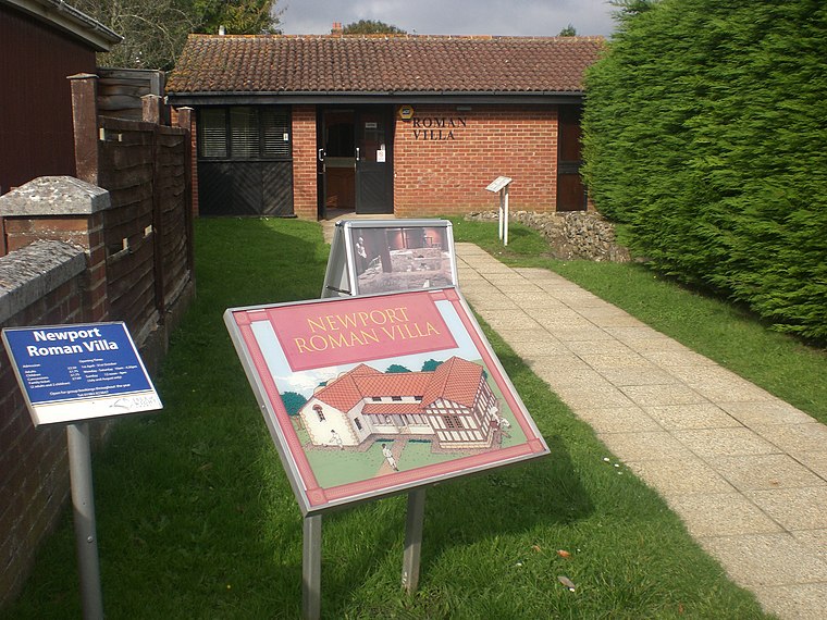
Photo: Editor5807, Public domain.
Newport Roman Villa was a Romano-British farmhouse constructed in 280 AD. It is located near to Newport, Isle of Wight. Newport Roman Villa is situated 900 feet northwest of Pod HQ.
Carisbrooke Castle
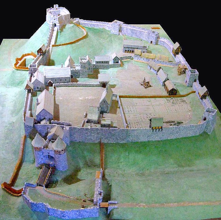
Photo: Charles D P Miller, CC BY 2.0.
Carisbrooke Castle is a historic motte-and-bailey castle located in the village of Carisbrooke, Isle of Wight, England. Charles I was imprisoned at the castle in the months prior to his trial. Carisbrooke Castle is situated 1 mile west of Pod HQ.
Church of St John the Baptist
Church

Photo: Hassocks5489, CC0.
The Church of St. John the Baptist, Newport is a parish church in the Church of England located in Newport, Isle of Wight. It is a Grade II listed building, the only surviving building by the British architect Robert Gunter Wetten. Church of St John the Baptist is situated 1,900 feet northwest of Pod HQ.
Places in the Area
Nearby places include Shide and Barton.
Shide
Suburb

Photo: Graham Horn, CC BY-SA 2.0.
Shide is a small settlement on the Isle of Wight, some of which is considered to be in the Newport conurbation. Shide Hill House, which was demolished in the 1970s, was situated with its back towards St.
Barton
Suburb
Barton is an area in the east of Newport on the Isle of Wight. Transport is provided by Southern Vectis community service route 39 to the town centre and standard service routes 8 and 9 to Sandown and Ryde, which run nearby.
Fairlee
Suburb
Fairlee is a suburb of Newport, on the Isle of Wight, on the east side of the River Medina. Fairlee Road runs through the area. During a week in June each year the main road northbound is completely closed to vehicles during the Isle of Wight Festival.
Pod HQ
- Type: Industrial building
- Categories: building and industry
- Location: Newport, Isle of Wight, South East England, England, United Kingdom, Britain and Ireland, Europe
- View on OpenStreetMap
Latitude
50.69276° or 50° 41′ 34″ northLongitude
-1.28898° or 1° 17′ 20″ westOpen location code
9C2WMPV6+4COpenStreetMap ID
way 484775077OpenStreetMap feature
building=industrial
This page is based on OpenStreetMap, Wikidata, and Wikimedia Commons.
We’d love your help improving our open data sources. Thank you for contributing.
Satellite Map
Discover Pod HQ from above in high-definition satellite imagery.
Notable Places Nearby
Highlights include The Church of Jesus Christ of Latter-day Saints and Pan Mill Meadows.
Nearby Places
Explore places such as Shide Path and Medina Dental Laboratory.
Isle of Wight: Must-Visit Destinations
Delve into Cowes, Ryde, Ventnor, and Yarmouth.
Curious Industrial Buildings to Discover
Uncover intriguing industrial buildings from every corner of the globe.
About Mapcarta. Data © OpenStreetMap contributors and available under the Open Database License". Text is available under the CC BY-SA 4.0 license, except for photos, directions, and the map. Photo: Adrian Farwell, CC BY 3.0.