Getränke Both
Getränke Both is a beverage shop in Urmitz, Mayen-Koblenz, Rhineland-Palatinate which is located on Freiherr-vom-Stein-Straße. Getränke Both is situated nearby to the town hall Rathaus Urmitz, as well as near Les-Noes-Platz.| Tap on a place to explore it |
- Opening hours:
Monday—Friday: 8:00 AM—noon and 1:30 PM—6:00 PM
Saturday: 9:00 AM—1:00 PM
Sunday: closed - Type: Beverage shop
- Address: Freiherr-vom-Stein-Straße 37, Urmitz, 56220
- Wheelchair access: yes
Places of Interest Nearby
Highlights include St. Georg and Urmitzer Eisenbahnbrücke.
St. Georg
Church
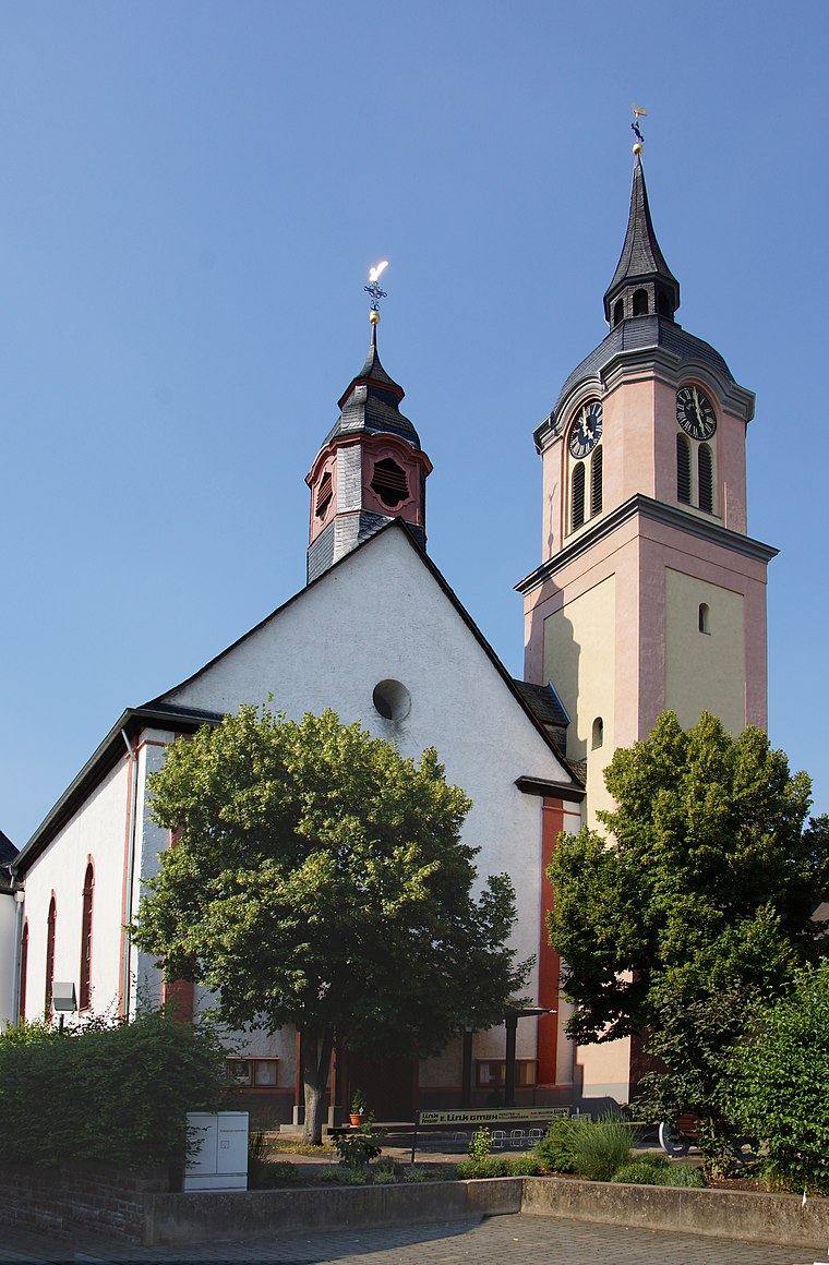
Photo: Tohma, CC BY-SA 4.0.
St. Georg is a church, which is situated 330 metres north of Getränke Both.
Urmitzer Eisenbahnbrücke
Bridge

Photo: Schaengel, CC BY-SA 3.0 de.
Urmitzer Eisenbahnbrücke is a bridge, which is situated 1 km northeast of Getränke Both.
St. Sylvester (Kaltenengers)
Church

Photo: Wolkenkratzer, CC BY-SA 4.0.
St. Sylvester (Kaltenengers) is a church, which is situated 1½ km east of Getränke Both.
Places in the Area
Nearby places include Kaltenengers and Engers.
Kaltenengers
Village
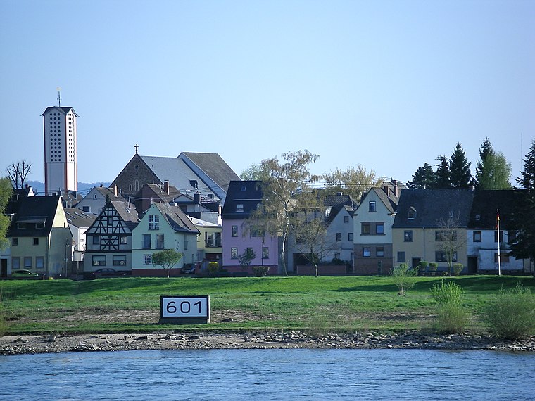
Photo: Volkes Stimme, CC BY-SA 3.0 de.
Kaltenengers is a municipality in the district of Mayen-Koblenz in Rhineland-Palatinate, western Germany.
Engers
Suburb

Photo: Möwe-rhein601, CC BY-SA 3.0.
Engers is a district of Neuwied on the right banks of the river Rhine in Germany located next to Koblenz in Rhineland-Palatinate. Engers has 5,367 inhabitants. It is highwater-endangered by its direct contact with the river Rhine. Engers is situated 2½ km northeast of Getränke Both.
Mülhofen
Suburb

Photo: LigaDue, CC BY-SA 4.0.
Mülhofen is a suburb, which is situated 3 km northeast of Getränke Both.
Getränke Both
- Category: shop
- Location: Urmitz, Mayen-Koblenz, Rhineland-Palatinate, Germany, Central Europe, Europe
- View on OpenStreetMap
Latitude
50.4138° or 50° 24′ 50″ northLongitude
7.51803° or 7° 31′ 5″ eastOpen location code
9F29CG79+G6OpenStreetMap ID
way 485571557OpenStreetMap feature
shop=beveragesOpenStreetMap attribute
wheelchair=yes
This page is based on OpenStreetMap, Wikidata, and Wikimedia Commons.
We’d love your help improving our open data sources. Thank you for contributing.
Satellite Map
Discover Getränke Both from above in high-definition satellite imagery.
Notable Places Nearby
Highlights include Les-Noes-Platz and Rathaus Urmitz.
Nearby Places
Explore places such as Getränke Abholmarkt and Ergo Versicherung Christian Emde.
Rhineland-Palatinate: Must-Visit Destinations
Delve into Mainz, Trier, Koblenz, and Worms.
Curious Beverage Shops to Discover
Uncover intriguing beverage shops from every corner of the globe.
About Mapcarta. Data © OpenStreetMap contributors and available under the Open Database License". Text is available under the CC BY-SA 4.0 license, except for photos, directions, and the map. Photo: Traveler100, CC BY-SA 3.0.