Steinbruch Albersweiler
Steinbruch Albersweiler is a quarry in Albersweiler, Südliche Weinstraße, Rhineland-Palatinate. Steinbruch Albersweiler is situated nearby to the winery Weingut Speisegaststätte Gebr. Nägle, as well as near the railway stop Albersweiler railway station.| Tap on a place to explore it |
Places of Interest Nearby
Highlights include Albersweiler railway station and Löwensteiner Schloss.
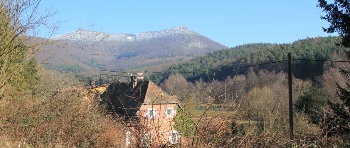
Albersweiler railway station
Railway stop

Photo: Antifaschist 666, CC BY-SA 3.0.
Albersweiler railway station is a railway stop, which is situated 490 metres southeast of Steinbruch Albersweiler.
Löwensteiner Schloss
Historic building

Photo: Joachim Specht, CC0.
Löwensteiner Schloss is a historic building, which is situated 1¼ km east of Steinbruch Albersweiler.

Places in the Area
Nearby places include Vogelstockerhof and Queichhambach.

Birkweiler
Village

Photo: Gerd Eichmann, CC BY-SA 3.0.
Birkweiler is a municipality in the Südliche Weinstraße district, in Rhineland-Palatinate, Germany.
Steinbruch Albersweiler
- Type: Quarry
- Category: industry
- Location: Albersweiler, Südliche Weinstraße, Rhineland-Palatinate, Germany, Central Europe, Europe
- View on OpenStreetMap
Latitude
49.22258° or 49° 13′ 21″ northLongitude
8.02129° or 8° 1′ 17″ eastOperator
Basalt-Actien-GesellschaftOpen location code
8FXC62FC+2GOpenStreetMap ID
way 488771726OpenStreetMap feature
landuse=quarry
This page is based on OpenStreetMap, Wikidata, and Wikimedia Commons.
We’d love your help improving our open data sources. Thank you for contributing.
Satellite Map
Discover Steinbruch Albersweiler from above in high-definition satellite imagery.
Notable Places Nearby
Highlights include Weingut Speisegaststätte Gebr. Nägle and Pfarrer-Hamm-Platz.
Nearby Places
Explore places such as Steinbruch Albersweiler and Albersweiler, Steinbruch.
Rhineland-Palatinate: Must-Visit Destinations
Delve into Mainz, Trier, Koblenz, and Worms.
Curious Quarries to Discover
Uncover intriguing quarries from every corner of the globe.
About Mapcarta. Data © OpenStreetMap contributors and available under the Open Database License". Text is available under the CC BY-SA 4.0 license, except for photos, directions, and the map. Photo: Traveler100, CC BY-SA 3.0.