Pentagliss
Pentagliss is a swimming pool in Gond-Pontouvre, Arrondissement of Angoulême, Nouvelle-Aquitaine. Pentagliss is situated nearby to the grassland Nautilis, as well as near the swimming pool Piscine à Vagues.| Tap on a place to explore it |
Places of Interest Nearby
Highlights include Angoulême station and CNBDI.
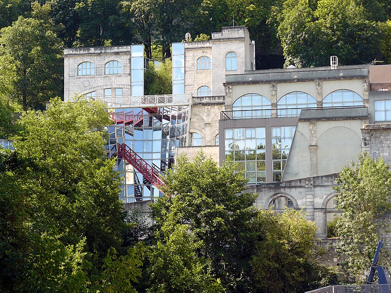
Angoulême station
Railway station

Photo: marsupilami92, CC BY 2.0.
Angoulême station is a railway station located in Angoulême, Charente, south-western France. The station was opened in 1852 and is located on the Paris–Bordeaux railway, Saintes-Angoulême railway and Limoges-Angoulême railway. Angoulême station is situated 3½ km southeast of Pentagliss.
Angoulême Cathedral
Church

Photo: Wikimedia, CC BY-SA 2.5.
Angoulême Cathedral is a Roman Catholic church in Angoulême, Charente, France. The cathedral is in the Romanesque architectural and sculptural tradition, and is the seat of the Bishop of Angoulême. Angoulême Cathedral is situated 4 km south of Pentagliss.
Places in the Area
Nearby places include Angoulême and Soyaux.
Angoulême

Photo: Inkey, CC BY-SA 3.0.
Angoulême is the capital of the Charente department. It lies about 135 km north of Bordeaux in south west France.
Soyaux
Town

Photo: Jack ma, CC BY-SA 3.0.
Soyaux is a commune in the Charente department in the Nouvelle-Aquitaine region in southwestern France. Soyaux is situated 6 km southeast of Pentagliss.
Brie
Village

Photo: Wikimedia, CC BY-SA 4.0.
Brie is a commune in the Charente department in southwestern France. Brie is situated 9 km northeast of Pentagliss.
Pentagliss
- Type: Swimming pool
- Categories: recreation area and sports location
- Location: Gond-Pontouvre, Arrondissement of Angoulême, Charente, Nouvelle-Aquitaine, France, Europe
- View on OpenStreetMap
Latitude
45.68408° or 45° 41′ 3″ northLongitude
0.1459° or 0° 8′ 45″ eastOpen location code
8FQ2M4MW+J9OpenStreetMap ID
way 491796661OpenStreetMap feature
leisure=swimming_pool
This page is based on OpenStreetMap, Wikidata, and Wikimedia Commons.
We’d love your help improving our open data sources. Thank you for contributing.
Satellite Map
Discover Pentagliss from above in high-definition satellite imagery.
Places with the Same Name
Discover other places named “Pentagliss”.
Notable Places Nearby
Highlights include Nautilis and Piscine à Vagues.
Nearby Places
Explore places such as Snack and Nautilis.
Nouvelle-Aquitaine: Must-Visit Destinations
Delve into Bordeaux, Deux-Sèvres, Poitiers, and Limoges.
Curious Swimming Pools to Discover
Uncover intriguing swimming pools from every corner of the globe.
About Mapcarta. Data © OpenStreetMap contributors and available under the Open Database License". Text is available under the CC BY-SA 4.0 license, except for photos, directions, and the map. Photo: JLPC, CC BY-SA 3.0.