Ironstone Bungalow
Ironstone Bungalow is a building in Eaton, Melton District, England. Ironstone Bungalow is situated nearby to the forest Harby Hills, as well as near the house The Lodge.| Tap on a place to explore it |
Places of Interest Nearby
Highlights include Church of St Guthlac, Stathern and Church of St Denys, Goadby Marwood.
Church of St Guthlac, Stathern
Church

Photo: Davearrgh, Public domain.
Church of St Guthlac, Stathern is situated 1½ miles north of Ironstone Bungalow.
Church of St Denys, Goadby Marwood
Church
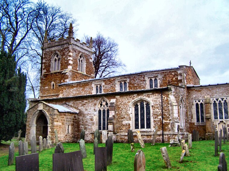
Photo: Kev747, Public domain.
Church of St Denys, Goadby Marwood is situated 1½ miles southeast of Ironstone Bungalow.
Church of St Michael and All Angels
Church

Photo: Rpriv2000, CC BY-SA 3.0.
Church of St Michael and All Angels is situated 2 miles west of Ironstone Bungalow.
Places in the Area
Nearby places include Eastwell and Goadby Marwood.
Eastwell
Village
Eastwell is a village and ecclesiastical parish in Leicestershire, England. The village's name means 'eastern spring/stream'. For the purposes of administration Eastwell is part of the civil parish of Eaton that, in turn, forms part of the borough of Melton.
Goadby Marwood
Village
Photo: Kate Jewell, CC BY-SA 2.0.
Goadby Marwood is a village and former civil parish, now in the parish of Eaton, in the Melton district, in the north of the English county of Leicestershire. Goadby Marwood is situated 1½ miles southeast of Ironstone Bungalow.
Hose
Village
Photo: Rpriv2000, CC BY-SA 3.0.
Hose is a village in the civil parish of Clawson, Hose and Harby, in the Borough of Melton and the county of Leicestershire, England. The town of Melton Mowbray is six miles to the south. In 2011 the built-up area had a population of 580. Hose is situated 2 miles west of Ironstone Bungalow.
Ironstone Bungalow
- Type: Building
- Location: Eaton, Melton District, Leicestershire, East Midlands, England, United Kingdom, Britain and Ireland, Europe
- View on OpenStreetMap
Latitude
52.84915° or 52° 50′ 57″ northLongitude
-0.86554° or 0° 51′ 56″ westOpen location code
9C4XR4XM+MQOpenStreetMap ID
way 500637309OpenStreetMap feature
building=yes
This page is based on OpenStreetMap, Wikidata, and Wikimedia Commons.
We’d love your help improving our open data sources. Thank you for contributing.
Satellite Map
Discover Ironstone Bungalow from above in high-definition satellite imagery.
Notable Places Nearby
Highlights include Harby Hills and The Lodge.
Nearby Places
Explore places such as Hill Top Farm and Hill Farm.
Leicestershire: Must-Visit Destinations
Delve into Leicester, Loughborough, Hinckley, and Melton Mowbray.
Curious Buildings to Discover
Uncover intriguing buildings from every corner of the globe.
About Mapcarta. Data © OpenStreetMap contributors and available under the Open Database License". Text is available under the CC BY-SA 4.0 license, except for photos, directions, and the map. Photo: Wikimedia, CC0.