Plaza de Cuelgamuros
Plaza de Cuelgamuros is a square in Puente de Vallecas, Madrid, Community of Madrid. Plaza de Cuelgamuros is situated nearby to the church Parroquia Dulce Nombre de María, as well as near the marketplace Mercado de Doña Carlota.| Tap on a place to explore it |
Places of Interest Nearby
Highlights include Vallecas Stadium and RESAD.
Vallecas Stadium
Stadium
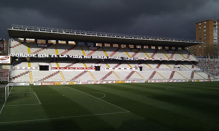
Photo: K3T0, CC BY 2.5 es.
Campo de Fútbol de Vallecas is a football stadium in the Madrid district of Puente de Vallecas, Spain. It currently hosts football matches and is the home of Primera Division club Rayo Vallecano. Vallecas Stadium is situated 1½ km south of Plaza de Cuelgamuros.
RESAD
College
 The Real Escuela Superior de Arte Dramático is a drama school in Madrid, Spain. RESAD is situated 1¼ km northwest of Plaza de Cuelgamuros.
Estrella
Metro station

Photo: Braniff747SP, CC BY-SA 3.0.
Estrella is a station on Line 9 of the Madrid Metro, serving the Estrella barrio. It is located in fare Zone A. The station is located directly below the M-30 Autopista, between the districts of Moratalaz to the east and Retiro to the west, and has entrances on both sides. Estrella is situated 740 metres north of Plaza de Cuelgamuros.
Places in the Area
Nearby places include Numancia and Media Legua.
Numancia
Quarter

Photo: frankblacknoir, CC BY-SA 3.0.
Numancia is an administrative neighborhood of Madrid belonging to the district of Puente de Vallecas. It has an area of 1.849172 km2. As of 1 March 2020, it has a population of 48,815.
Media Legua
Quarter

Photo: Wikimedia, CC BY-SA 2.5.
Media Legua is an administrative neighborhood of Madrid belonging to the district of Moratalaz. It has an area of 0.999539 km2. As of 1 March 2020, it has a population of 17,977.
Adelfas
Quarter

Photo: Wikimedia, CC BY-SA 3.0.
Adelfas is an administrative neighborhood in Madrid of the Retiro district. It is located in the extreme south of the district, so it only delimits with 3 of the 5 neighborhoods of the district: Pacífico to the west, Niño Jesús to the east and Estrella to the northeast.
Plaza de Cuelgamuros
- Type: Square
- Categories: pedestrian zone and locality
- Location: Puente de Vallecas, Madrid, Madrid, Community of Madrid, Central Spain, Spain, Iberia, Europe
- View on OpenStreetMap
Latitude
40.40467° or 40° 24′ 17″ northLongitude
-3.66098° or 3° 39′ 40″ westOpen location code
8CGRC83Q+VJOpenStreetMap ID
way 510085005OpenStreetMap feature
highway=pedestrianOpenStreetMap feature
place=square
This page is based on OpenStreetMap, Wikidata, and Wikimedia Commons.
We’d love your help improving our open data sources. Thank you for contributing.
Satellite Map
Discover Plaza de Cuelgamuros from above in high-definition satellite imagery.
Notable Places Nearby
Highlights include Parroquia Dulce Nombre de María and Mercado de Doña Carlota.
Nearby Places
Explore places such as Ahorramás and Yamaha.
Madrid: Must-Visit Destinations
Delve into Sol-Letras-Lavapiés, Salamanca, Retiro-Paseo del Arte, and Chamberí-Castellana.
Curious Squares to Discover
Uncover intriguing squares from every corner of the globe.
About Mapcarta. Data © OpenStreetMap contributors and available under the Open Database License". Text is available under the CC BY-SA 4.0 license, except for photos, directions, and the map. Photo: DonPaolo, CC BY-SA 3.0.