Ransbach (WW)
Ransbach (WW) is a building in Ransbach-Baumbach, Westerwaldkreis, Rhineland-Palatinate which is located on Bahnhofstraße. Ransbach (WW) is situated nearby to the church Ev. Kirchengemeinde Ransbach-Baumbach-Higert, as well as near the health club Fit+ Ransbach-Baumbach.| Tap on a place to explore it |
Places of Interest Nearby
Highlights include St. Markus and Felsengruppe Bühl.
St. Markus
Church
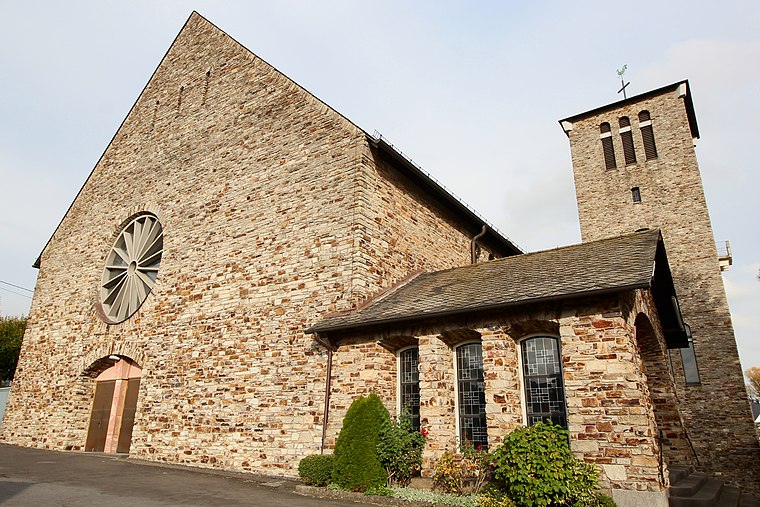
Photo: LigaDue, CC BY-SA 4.0.
St. Markus is a church, which is situated 280 metres north of Ransbach (WW).
Felsengruppe Bühl
Protected area

Photo: LigaDue, CC BY-SA 4.0.
Felsengruppe Bühl is a protected area, which is situated 3 km southwest of Ransbach (WW).
Evangelische Kirche
Church
 Evangelische Kirche is a church, which is situated 3½ km northeast of Ransbach (WW).
Places in the Area
Nearby places include Hundsdorf and Ebernhahn.
Hundsdorf
Village

Photo: Wolkenkratzer, CC BY-SA 4.0.
Hundsdorf is an Ortsgemeinde – a community belonging to a Verbandsgemeinde – in the Westerwaldkreis in Rhineland-Palatinate, Germany.
Ebernhahn
Village

Photo: LigaDue, CC BY-SA 4.0.
Ebernhahn is an Ortsgemeinde – a municipality belonging to a Verbandsgemeinde – in the Westerwaldkreis in Rhineland-Palatinate, Germany. Ebernhahn is situated 3 km east of Ransbach (WW).
Hilgert
Village

Photo: LigaDue, CC BY-SA 4.0.
Hilgert in the Kannenbäckerland is an Ortsgemeinde – a community belonging to a Verbandsgemeinde – in the Westerwaldkreis in Rhineland-Palatinate, Germany. Hilgert is situated 3 km southwest of Ransbach (WW).
Ransbach (WW)
- Type: Building
- Address: Bahnhofstraße 4, Ransbach-Baumbach, 56235
- Location: Ransbach-Baumbach, Westerwaldkreis, Rhineland-Palatinate, Germany, Central Europe, Europe
- View on OpenStreetMap
Latitude
50.46639° or 50° 27′ 59″ northLongitude
7.73049° or 7° 43′ 50″ eastOperator
EifelbahnOpen location code
9F29FP8J+H5OpenStreetMap ID
way 520191054OpenStreetMap feature
building=yesOpenStreetMap feature
railway=signal_box
This page is based on OpenStreetMap, Wikidata, and Wikimedia Commons.
We’d love your help improving our open data sources. Thank you for contributing.
Satellite Map
Discover Ransbach (WW) from above in high-definition satellite imagery.
Notable Places Nearby
Highlights include Ev. Kirchengemeinde Ransbach-Baumbach-Higert and Fit+ Ransbach-Baumbach.
Nearby Places
Explore places such as Ransbach-Baumbach and Ransbach Alter Bahnhof.
Rhineland-Palatinate: Must-Visit Destinations
Delve into Mainz, Trier, Koblenz, and Worms.
Curious Buildings to Discover
Uncover intriguing buildings from every corner of the globe.
About Mapcarta. Data © OpenStreetMap contributors and available under the Open Database License". Text is available under the CC BY-SA 4.0 license, except for photos, directions, and the map. Photo: Traveler100, CC BY-SA 3.0.