Place du 19 Avril 1944
Place du 19 Avril 1944 is a square in Rouen, Seine-Maritime, Normandy. Place du 19 Avril 1944 is situated nearby to the health club Revive, as well as near the library Bibliothèque Roger Parment.| Tap on a place to explore it |
Places of Interest Nearby
Highlights include Musée des Beaux-Arts de Rouen and Rouen Cathedral.
Musée des Beaux-Arts de Rouen
Museum
 The Musée des Beaux-Arts de Rouen is an art museum in Rouen, in Normandy in north-western France. It was established by Napoléon Bonaparte in 1801, and is housed in a building designed by Louis Sauvageot and built between 1877, and 1888. Musée des Beaux-Arts de Rouen is situated 170 metres north of Place du 19 Avril 1944.
Rouen Cathedral
Church
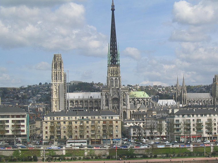
Photo: Wikimedia, CC BY-SA 3.0.
Rouen Cathedral is a Catholic church in Rouen, Normandy, France. It is the see of the Archbishop of Rouen, Primate of Normandy. It is famous for its three towers, each in a different style. Rouen Cathedral is situated 340 metres south of Place du 19 Avril 1944.
Musée Le Secq des Tournelles
Museum

Photo: Medunta, CC BY-SA 3.0.
Musée Le Secq des Tournelles is a museum, which is situated 160 metres northeast of Place du 19 Avril 1944.
Places in the Area
Nearby places include Espace du Palais and Rouen.

Rouen

Photo: stephane martin, CC BY-SA 2.0.
Rouen is the capital of the French region of Normandy on the River Seine, 135 km northwest from the centre of Paris. The city has a population of 110,000 and its metropolitan area includes some 666,000 inhabitants.
Bihorel
Village

Photo: Telwrmy, CC BY-SA 3.0.
Bihorel is a commune of the Seine-Maritime department in the Normandy region in northern France. It is a northeastern suburb of Rouen.
Place du 19 Avril 1944
- Type: Square
- Category: locality
- Location: Rouen, Arrondissement of Rouen, Seine-Maritime, Normandy, France, Europe
- View on OpenStreetMap
Latitude
49.4433° or 49° 26′ 36″ northLongitude
1.09395° or 1° 5′ 38″ eastOpen location code
8FX3C3VV+8HOpenStreetMap ID
way 54072700OpenStreetMap feature
place=square
This page is based on OpenStreetMap, Wikidata, and Wikimedia Commons.
We’d love your help improving our open data sources. Thank you for contributing.
Satellite Map
Discover Place du 19 Avril 1944 from above in high-definition satellite imagery.
Notable Places Nearby
Highlights include Place du 19 Avril 1944 and Revive.
Nearby Places
Explore places such as Au bout de l’errance and Blotti.
Normandy: Must-Visit Destinations
Delve into Orne, Rouen, Seine-Maritime, and Le Havre.
Curious Squares to Discover
Uncover intriguing squares from every corner of the globe.
About Mapcarta. Data © OpenStreetMap contributors and available under the Open Database License". Text is available under the CC BY-SA 4.0 license, except for photos, directions, and the map. Photo: Inkey, CC BY-SA 3.0.