Polden B
Polden B is a building in Bathampton, Bath and North East Somerset, England. Polden B is situated nearby to the grassland Westwood, as well as near the archaeological site tumulus.| Tap on a place to explore it |
Places of Interest Nearby
Highlights include Sham Castle and Bath Spa Railway Station.
Sham Castle

Photo: Paul Brooker, CC BY-SA 2.0.
Sham Castle is a folly on Claverton Down overlooking the city of Bath, Somerset, England. It is a Grade II* listed building. It is a screen wall with a central pointed arch flanked by two 3-storey circular turrets, which extend sideways to a 2-storey square tower at each end of the wall. Sham Castle is situated 1,300 feet northwest of Polden B.
Bath Spa Railway Station
Railway station
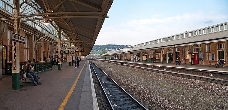
Photo: Diliff, CC BY-SA 3.0.
Bath Spa railway station is the principal station serving the city of Bath in Somerset, England. It is on the Great Western Main Line, 106 miles 71 chains down the line from the zero point at London Paddington between Chippenham to the east and Oldfield Park to the west. Bath Spa Railway Station is situated 1 mile west of Polden B.
Roman Baths
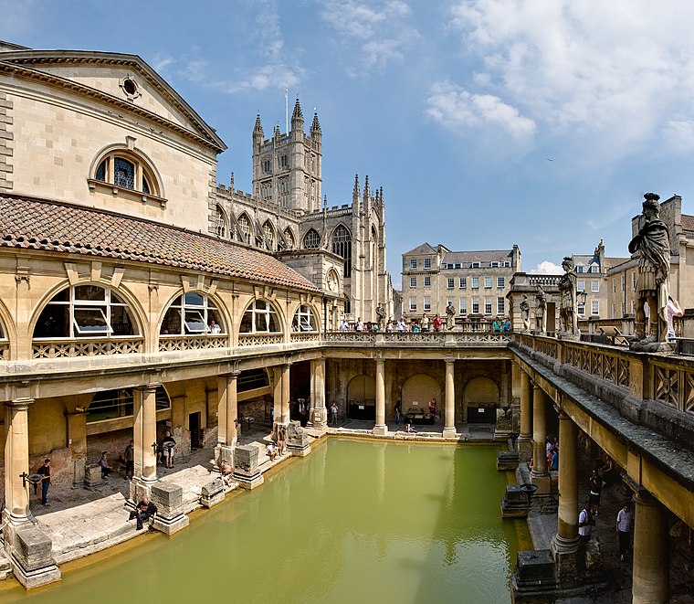 The Roman Baths are well-preserved thermae in the city of Bath, Somerset, England. A temple was constructed on the site between 60 and 70 AD in the first few decades of Roman Britain. Roman Baths is situated 1¼ miles west of Polden B.
Places in the Area
Nearby places include Bathwick Hill and Claverton Down.
Bathwick Hill
Locality

Photo: Diliff, CC BY-SA 3.0.
Bathwick Hill is a street lined with historic houses in Bath, Somerset, England, many of which are designated as listed buildings. It climbs south east from the A36 towards the University of Bath on Claverton Down, providing views over the city.
Claverton Down
Suburb

Photo: Bill Boaden, CC BY-SA 2.0.
Claverton Down is a suburb on the south-east hilltop edge of Bath, Somerset, England. It is linked to the Bathwick area of the city by Bathwick Hill. Primarily a rural area with relatively few houses, it is home to the University of Bath, the headquarters of Wessex Water and a private golf course, the Bath Golf Course.
Bathwick
Suburb
Bathwick is an area and electoral ward in the city of Bath, in the Bath and North East Somerset district, in the ceremonial county of Somerset, England, on the opposite bank of the River Avon to the historic city centre.
Polden B
Latitude
51.38051° or 51° 22′ 50″ northLongitude
-2.33268° or 2° 19′ 58″ westLevels
6Open location code
9C3V9MJ8+6WOpenStreetMap ID
way 546830340OpenStreetMap feature
building=hall_of_residence
This page is based on OpenStreetMap, Wikidata, and Wikimedia Commons.
We’d love your help improving our open data sources. Thank you for contributing.
Satellite Map
Discover Polden B from above in high-definition satellite imagery.
Notable Places Nearby
Highlights include Westwood and tumulus.
Nearby Places
Explore places such as West Accommodation Centre and CAFE at Polden.
England: Must-Visit Destinations
Delve into London, Manchester, Sheffield, and Leeds.
Curious Buildings to Discover
Uncover intriguing buildings from every corner of the globe.
About Mapcarta. Data © OpenStreetMap contributors and available under the Open Database License". Text is available under the CC BY-SA 4.0 license, except for photos, directions, and the map. Photo: sidibousaid, CC BY 2.0.