Mauds
Mauds is an ice cream parlor in Antrim and Newtownabbey, Northern Ireland. Mauds is situated nearby to Abbey Presbyterian Church, as well as near Monkstown Boxing Club.| Tap on a place to explore it |
Places of Interest Nearby
Highlights include Monkstown Community School and Church of Ireland.
Monkstown Community School
School
Monkstown Community School was a mixed non-denominational secondary school in Monkstown, County Antrim, Northern Ireland. It closed in 2015 when it merged with Newtownabbey Community High School to form Abbey Community College. Monkstown Community School is situated 510 feet northwest of Mauds.
Church of Ireland
Church

Photo: JohnArmagh, CC BY-SA 4.0.
The Church of Ireland is a Christian church in Ireland, and an autonomous province of the Anglican Communion. It is organised on an all-Ireland basis and is the second-largest Christian church on the island after the Roman Catholic Church. Church of Ireland is situated 1½ miles southwest of Mauds.
Jordanstown railway station
Railway station
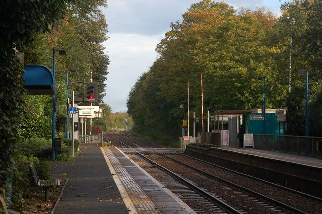
Photo: Albert Bridge, CC BY-SA 2.0.
Jordanstown railway station serves Jordanstown and the University of Ulster in Newtownabbey, Northern Ireland. A park and ride facility for the station has been proposed to ease congestion on the main Jordanstown Road. Jordanstown railway station is situated 1 mile east of Mauds.
Places in the Area
Nearby places include Jordanstown and Newtownabbey.
Jordanstown
Suburb
Photo: Albert Bridge, CC BY-SA 2.0.
Jordanstown is a townland and electoral ward in County Antrim, Northern Ireland. It is within the urban area of Newtownabbey and the Antrim and Newtownabbey Borough Council area.
Newtownabbey

Photo: Pastor Sam, CC BY 3.0.
Newtownabbey is a district just north of Belfast. It's short of tourist sights and facilities, and you'd only come here for business or to attend the university.
Ballyrobert
Village
Ballyrobert is a small village in County Antrim, Northern Ireland. It is about 4 km south of Ballyclare and has developed around the junction of the Ballyrobert Road and the Mossley Road/The Longshot. Ballyrobert is situated 4 miles northwest of Mauds.
Mauds
- Type: Ice cream parlor
- Categories: building and food
- Location: Antrim and Newtownabbey, Northern Ireland, United Kingdom, Britain and Ireland, Europe
- View on OpenStreetMap
Latitude
54.68956° or 54° 41′ 22″ northLongitude
-5.91673° or 5° 55′ 0″ westOpen location code
9C6PM3QM+R8OpenStreetMap ID
way 551464287OpenStreetMap feature
amenity=ice_creamOpenStreetMap feature
building=yes
This page is based on OpenStreetMap, Wikidata, and Wikimedia Commons.
We’d love your help improving our open data sources. Thank you for contributing.
Satellite Map
Discover Mauds from above in high-definition satellite imagery.
Places with the Same Name
Discover other places named “Mauds”.
Notable Places Nearby
Highlights include Abbey Presbyterian Church and Monkstown Boxing Club.
Nearby Places
Explore places such as ToTo and Tesco Express.
Northern Ireland: Must-Visit Destinations
Delve into Belfast, Derry, Giant’s Causeway, and Armagh.
Curious Ice Cream Parlors to Discover
Uncover intriguing ice cream parlors from every corner of the globe.
About Mapcarta. Data © OpenStreetMap contributors and available under the Open Database License". Text is available under the CC BY-SA 4.0 license, except for photos, directions, and the map. Photo: Chmee2, CC BY 3.0.