Taman Mahkota Permai
Taman Mahkota Permai is a residential area in Pahang, East Coast. Taman Mahkota Permai is situated nearby to the recreation area Taman Permainan Mahkota Permai, as well as near the government office MSC Pusat e-Khidmat (MY-EG).| Tap on a place to explore it |
Places of Interest Nearby
Highlights include Terminal Sentral Kuantan.
Terminal Sentral Kuantan
Bus station

Photo: Chongkian, CC BY-SA 4.0.
Terminal Sentral Kuantan is a public transportation terminal in Kuantan, Pahang, Malaysia. It is located at Bandar Indera Mahkota. The terminal is the largest public transportation terminal in the East Coast of Peninsula Malaysia. Terminal Sentral Kuantan is situated 1½ km east of Taman Mahkota Permai.
Places in the Area
Nearby places include Bandar Indera Mahkota and Kuantan.
Bandar Indera Mahkota
Suburb

Photo: Chongkian, CC BY-SA 4.0.
Indera Mahkota is a township in Kuantan, Pahang, Malaysia. Bandar Indera Mahkota is situated 2½ km east of Taman Mahkota Permai.
Kuantan
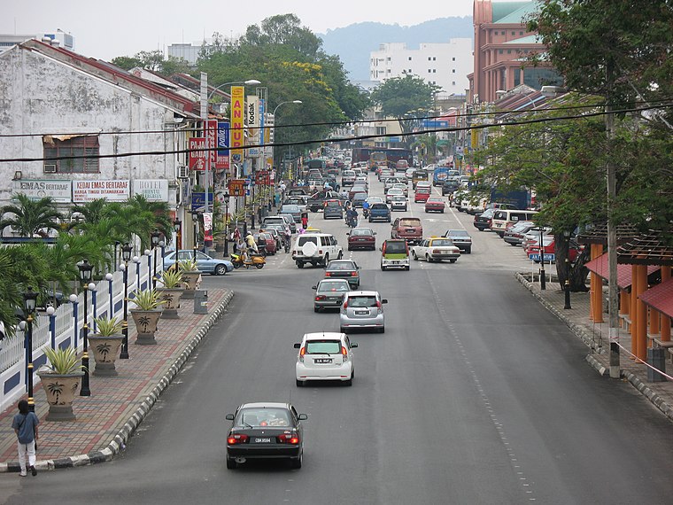
Photo: Only Truth, Public domain.
Kuantan is a city and the state capital of Pahang, Malaysia. It is located near the mouth of the Kuantan River. Kuantan is the 12th largest city in Malaysia based on a 2020 population of 548,014 and the largest city on the East Coast of Peninsular Malaysia.
Tanjung Lumpur
Suburb
Tanjung Lumpur is a traditional fishing village located near the Kuantan river in Kuantan District, Pahang, Malaysia. It is loosely translated into English as the " Cape of Mud". Tanjung Lumpur is situated 8 km east of Taman Mahkota Permai.
Taman Mahkota Permai
- Type: Residential area
- Location: Pahang, East Coast, Malaysia, Southeast Asia, Asia
- View on OpenStreetMap
Latitude
3.82774° or 3° 49′ 40″ northLongitude
103.27048° or 103° 16′ 14″ eastOpen location code
6PM5R7HC+35OpenStreetMap ID
way 557930937OpenStreetMap feature
landuse=residential
This page is based on OpenStreetMap, Wikidata, and Wikimedia Commons.
We’d love your help improving our open data sources. Thank you for contributing.
Satellite Map
Discover Taman Mahkota Permai from above in high-definition satellite imagery.
Notable Places Nearby
Highlights include Taman Permainan Mahkota Permai and MSC Pusat e-Khidmat (MY-EG).
Nearby Places
Explore places such as Taman Astana View and ACC Automotive Care Centre.
Pahang: Must-Visit Destinations
Delve into Cameron Highlands, Kuantan, Genting Highlands, and Taman Negara.
Curious Residential Areas to Discover
Uncover intriguing residential areas from every corner of the globe.
About Mapcarta. Data © OpenStreetMap contributors and available under the Open Database License". Text is available under the CC BY-SA 4.0 license, except for photos, directions, and the map. Photo: Wikimedia, CC0.