Town hall of Sesto Fiorentino
Town hall of Sesto Fiorentino is a town hall in Sesto Fiorentino, Florence, Tuscany. Town hall of Sesto Fiorentino is situated nearby to the police station Polizia Municipale, as well as near Piazza Vittorio Veneto.| Tap on a place to explore it |
- Type: Town hall
- Description: building in Sesto Fiorentino, Italy
- Also known as: “Comune di Sesto Fiorentino”
Places of Interest Nearby
Highlights include Parish church of San Martino and Palazzo Pretorio.
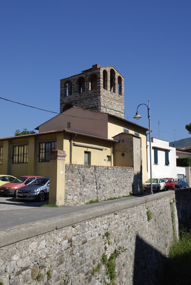
Parish church of San Martino
Church

Photo: Vignaccia76, CC BY-SA 3.0.
Parish church of San Martino is situated 160 metres south of Town hall of Sesto Fiorentino.
Palazzo Pretorio
Historic building

Photo: Tuscanycalling, CC BY-SA 3.0.
Palazzo Pretorio is a historic building, which is situated 290 metres northeast of Town hall of Sesto Fiorentino.
Sesto Fiorentino railway stop
Railway station

Photo: Valentino1, CC BY-SA 3.0.
Sesto Fiorentino railway stop is a railway station, which is situated 550 metres west of Town hall of Sesto Fiorentino.
Places in the Area
Nearby places include Sesto Fiorentino and Colonnata.
Sesto Fiorentino
Town

Photo: Assianir, CC BY-SA 3.0.
Sesto Fiorentino, known locally as just Sesto, is a commune in the Metropolitan City of Florence, Tuscany, central Italy.

Town hall of Sesto Fiorentino
- Categories: city hall, building, public building, and government building
- Location: Sesto Fiorentino, Florence, Tuscany, Central Italy, Italy, Europe
- View on OpenStreetMap
Latitude
43.83214° or 43° 49′ 56″ northLongitude
11.19842° or 11° 11′ 54″ eastOpen location code
8FMHR5JX+V9OpenStreetMap ID
way 558841942OpenStreetMap feature
amenity=townhallOpenStreetMap feature
building=publicWikidata ID
Q65008564
This page is based on OpenStreetMap, Wikidata, and Wikimedia Commons.
We’d love your help improving our open data sources. Thank you for contributing.
Satellite Map
Discover Town hall of Sesto Fiorentino from above in high-definition satellite imagery.
In Other Languages
From German to Italian—“Town hall of Sesto Fiorentino” goes by many names.
- German: “Rathaus von Sesto Fiorentino”
- Italian: “Palazzo comunale”
Notable Places Nearby
Highlights include Comune di Sesto Fiorentino and Comune di Sesto Fiorentino - U.R.P..
Nearby Places
Explore places such as Giuseppe Pescetti and Vittorio Veneto Municipio.
Florence: Must-Visit Destinations
Delve into Florence, Scandicci, Fiesole, and Greve in Chianti.
Curious Town Halls to Discover
Uncover intriguing town halls from every corner of the globe.
About Mapcarta. Data © OpenStreetMap contributors and available under the Open Database License". Text is available under the CC BY-SA 4.0 license, except for photos, directions, and the map. Photo: Sailko, CC BY 3.0.