BP
BP is a gas station in Rustington, Arun District, England which is located on Worthing Road. BP is situated nearby to Rustington Community Primary School, as well as near Summerlea Community Primary School.| Tap on a place to explore it |
Places of Interest Nearby
Highlights include The Parish Church of St Peter and St Paul and Angmering railway station.
The Parish Church of St Peter and St Paul
Church

Photo: The Voice of Hassocks, CC0.
The Parish Church of St Peter and St Paul is situated 2,700 feet south of BP.
Angmering railway station
Railway station

Photo: Janine Forbes, CC BY-SA 2.0.
Angmering is a railway station on the West Coastway Line, on the border of Angmering and East Preston, West Sussex in the district of Arun. It was opened in 1846. Angmering railway station is situated 1 mile east of BP.
St Nicholas Church, Poling
Church

Photo: Rjhfandclf, CC BY-SA 3.0.
St Nicholas Church is a Grade I listed parish church located in the village of Poling, West Sussex, England. The church exhibits architectural elements from the Saxon period through to the 15th century. St Nicholas Church, Poling is situated 1 mile north of BP.
Places in the Area
Nearby places include Rustington and Poling.
Rustington
Village
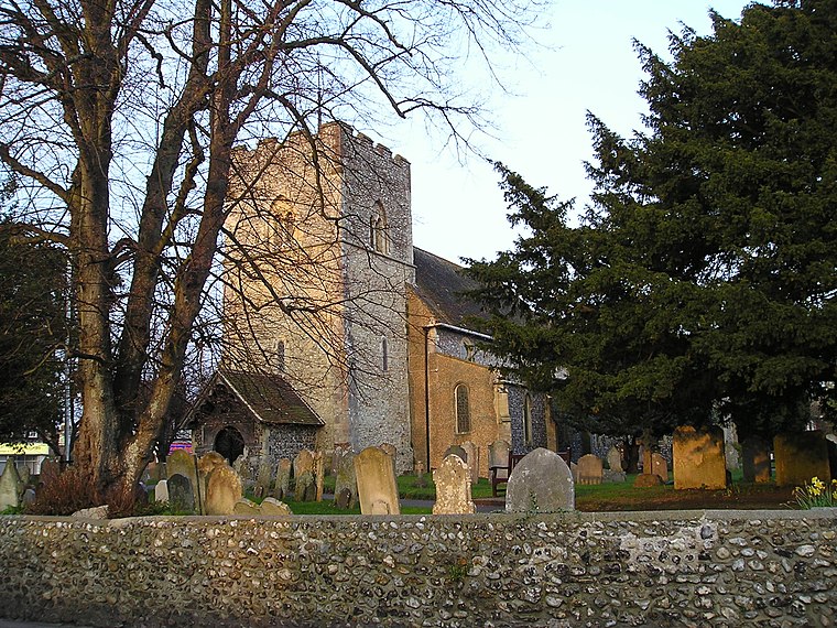
Photo: Dashers, Public domain.
Rustington is a village and civil parish in the Arun District of West Sussex. Rustington is approximately at the midpoint of the West Sussex coast and midway between Chichester and Brighton.
Poling
Village
Photo: Rjhfandclf, CC BY-SA 3.0.
Poling is a village and civil parish in the Arun District of West Sussex, England, 2 miles southeast of Arundel on a minor road south of the A27. About 25% of the parish is wooded foothill slopes of the South Downs which is the area north of the A27 here.
East Preston
Village

Photo: The Voice of Hassocks, CC0.
East Preston is a coastal village and civil parish in the Arun District of West Sussex, England. It lies roughly halfway between Littlehampton and Worthing.
BP
- Type: Gas station
- Address: Worthing Road, Rustington, Littlehampton
- Category: transportation
- Location: Rustington, Arun District, West Sussex, South East England, England, United Kingdom, Britain and Ireland, Europe
- View on OpenStreetMap
Latitude
50.81778° or 50° 49′ 4″ northLongitude
-0.51008° or 0° 30′ 36″ westBrand
BPOperator
BP Express Shopping LimitedOpen location code
9C2XRF9Q+4XOpenStreetMap ID
way 558870564OpenStreetMap feature
amenity=fuel
This page is based on OpenStreetMap, Wikidata, and Wikimedia Commons.
We’d love your help improving our open data sources. Thank you for contributing.
Satellite Map
Discover BP from above in high-definition satellite imagery.
Notable Places Nearby
Highlights include Rustington Community Primary School and Summerlea Community Primary School.
Nearby Places
Explore places such as Wild Bean Café and M&S Simply Food.
West Sussex: Must-Visit Destinations
Delve into Chichester, Crawley, Worthing, and Horsham.
Curious Gas Stations to Discover
Uncover intriguing gas stations from every corner of the globe.
About Mapcarta. Data © OpenStreetMap contributors and available under the Open Database License". Text is available under the CC BY-SA 4.0 license, except for photos, directions, and the map. Photo: wildlife encounters, CC BY 2.0.