Forest Park Place
Forest Park Place is a residential area in City of Detroit, Wayne County, Michigan which is located on East Canfield Street. Forest Park Place is situated nearby to Sweetest Heart of Mary Roman Catholic Church, as well as near St. Josaphat Roman Catholic Church.| Tap on a place to explore it |
Places of Interest Nearby
Highlights include Sweetest Heart of Mary Roman Catholic Church and St. Josaphat Roman Catholic Church.
Sweetest Heart of Mary Roman Catholic Church
Church

Photo: Nheyob, CC BY-SA 3.0.
The Sweetest Heart of Mary Roman Catholic Church is located at 4440 Russell Street in Detroit, Michigan, in the Forest Park neighborhood on the city's central East side. Sweetest Heart of Mary Roman Catholic Church is situated 710 feet northeast of Forest Park Place.
St. Josaphat Roman Catholic Church
Church

Photo: Andrew Jameson, CC BY-SA 3.0.
St. Josaphat Roman Catholic Church is a Roman Catholic church located at 715 East Canfield Street in Detroit, Michigan. It was listed on the National Register of Historic Places in 1982 and designated a Michigan State Historic Site in 1985. St. Josaphat Roman Catholic Church is situated 970 feet west of Forest Park Place.
Ford Field
Stadium
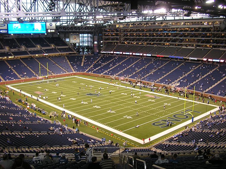 Ford Field is a domed American football stadium located in Detroit, Michigan, U.S. It primarily serves as the home of the Detroit Lions of the National Football League, the Mid-American Conference championship game, and the annual GameAbove Sports Bowl… Ford Field is situated 1¼ miles south of Forest Park Place.
Places in the Area
Nearby places include Midtown-New Center and Milwaukee Junction.
Midtown-New Center

Photo: Ken Lund, CC BY-SA 2.0.
Midtown is the cultural center of Detroit. It is home to several museums and galleries, such as the Detroit Institute of Arts and the Charles H. Wright Museum of African American History.
Milwaukee Junction
Neighborhood
Milwaukee Junction is an area in Detroit, Michigan, east of New Center. Located near the railroad junction of the Grand Trunk Western Railroad's predecessors Detroit, Grand Haven and Milwaukee Railway and the Chicago, Detroit and Canada Grand Trunk Junction, the area encompasses the streets of East Grand Boulevard to the north, St.
Lafayette Park
Neighborhood
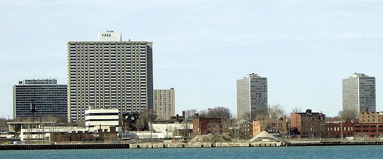
Photo: Mikerussell, CC BY-SA 3.0.
Lafayette Park is a neighborhood located east of Downtown Detroit. It contains a residential area of some 4,900 people and covers 0.37 sq mi. The northern section, planned and partially built in the 1950s by Ludwig Mies van der Rohe, is listed in the National Register of Historic Places; it was designated a National Historic Landmark District in 2015.
Forest Park Place
- Type: Residential area
- Address: 1130 East Canfield Street, Detroit, MI 48207
- Location: City of Detroit, Wayne County, Michigan, Midwest, United States, North America
- View on OpenStreetMap
Latitude
42.35652° or 42° 21′ 24″ northLongitude
-83.04901° or 83° 2′ 56″ westOperator
Detroit Housing CommissionOpen location code
86JR9X42+J9OpenStreetMap ID
way 563502461OpenStreetMap feature
landuse=residential
This page is based on OpenStreetMap, Wikidata, and Wikimedia Commons.
We’d love your help improving our open data sources. Thank you for contributing.
Satellite Map
Discover Forest Park Place from above in high-definition satellite imagery.
Notable Places Nearby
Highlights include Forest Park and St. Josaphat Roman Catholic Church.
Nearby Places
Explore places such as Friendship Meadows Apartments and Forest Park Apartments.
Wayne County: Must-Visit Destinations
Delve into Detroit, Dearborn, Downtown Detroit, and Livonia.
Curious Residential Areas to Discover
Uncover intriguing residential areas from every corner of the globe.
About Mapcarta. Data © OpenStreetMap contributors and available under the Open Database License". Text is available under the CC BY-SA 4.0 license, except for photos, directions, and the map. Photo: Wikimedia, CC0.