AT&T Belleville Northeast central office
AT&T Belleville Northeast central office is a building in Charter Township of Van Buren, Wayne County, Michigan which is located on Tyler Road. AT&T Belleville Northeast central office is situated nearby to Haggerty Neighborhood Park, as well as near Wayne County Community College District - Ted Scott Campus.| Tap on a place to explore it |
Places in the Area
Nearby places include Belleville and Romulus.
Belleville
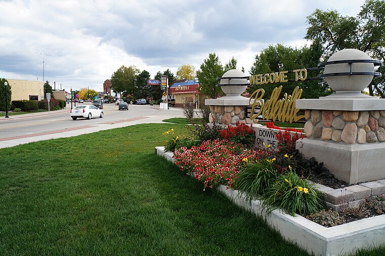
Photo: PeRshGo, CC BY-SA 3.0.
Belleville is a city in Wayne County, Michigan, United States. A western suburb of Detroit, Belleville is located roughly 29 miles southwest of downtown Detroit, and 18 miles southeast of Ann Arbor, and is completely surrounded by Van Buren Township.
Romulus

Photo: Traveler100, CC BY-SA 3.0.
Romulus is a city in Wayne County in the state of Michigan. It is the city in which Detroit Metro Airport is located.
Wayne
 Wayne is a city in Wayne County in the U.S. state of Michigan. A western suburb of Detroit, Wayne is located about 18 miles southwest of downtown Detroit.
AT&T Belleville Northeast central office
- Type: Building
- Address: 41866 Tyler Road, Belleville, MI 48111
- Location: Charter Township of Van Buren, Wayne County, Michigan, Midwest, United States, North America
- View on OpenStreetMap
Latitude
42.23611° or 42° 14′ 10″ northLongitude
-83.44981° or 83° 26′ 59″ westOperator
AT&T InternetOpen location code
86JR6HP2+C3OpenStreetMap ID
way 567605670OpenStreetMap feature
building=yes
This page is based on OpenStreetMap, Wikidata, and Wikimedia Commons.
We’d love your help improving our open data sources. Thank you for contributing.
Satellite Map
Discover AT&T Belleville Northeast central office from above in high-definition satellite imagery.
Notable Places Nearby
Highlights include Haggerty Neighborhood Park and Wayne County Community College District - Ted Scott Campus.
Nearby Places
Explore places such as J P Morgan Chase & Co. and Douglass Substation.
Wayne County: Must-Visit Destinations
Delve into Detroit, Dearborn, Downtown Detroit, and Livonia.
Curious Buildings to Discover
Uncover intriguing buildings from every corner of the globe.
About Mapcarta. Data © OpenStreetMap contributors and available under the Open Database License". Text is available under the CC BY-SA 4.0 license, except for photos, directions, and the map. Photo: Wikimedia, CC0.