Victoria Park Centre
Victoria Park Centre is a social service facility in Manchester, England which is located on Daisy Bank Road. Victoria Park Centre is situated nearby to the church Victoria Park Christian Fellowship, as well as near St. Joseph’s.| Tap on a place to explore it |
Places of Interest Nearby
Highlights include Victoria Baths and Edgar Wood Centre.
Victoria Baths

Photo: BesigedB, Public domain.
Victoria Baths is a Grade II* listed building, in the Chorlton-on-Medlock area of Manchester, England. The baths opened to the public in 1906 and cost £59,144 to build. Victoria Baths is situated 1,200 feet west of Victoria Park Centre.
Edgar Wood Centre
Church
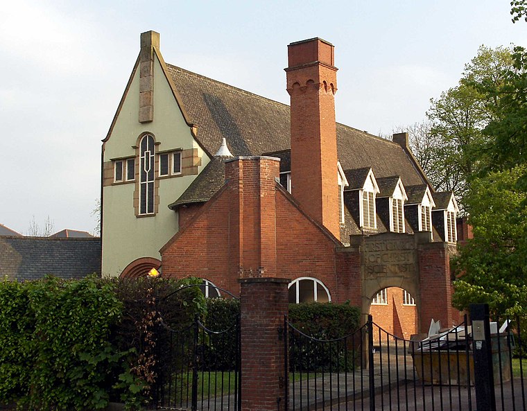
Photo: Stemonitis, CC BY 2.5.
The Edgar Wood Centre is a former Church of Christ, Scientist building in Victoria Park, Manchester, England. The church was designed by Edgar Wood in 1903. Edgar Wood Centre is situated 1,200 feet west of Victoria Park Centre.
Manchester Central Mosque
Mosque
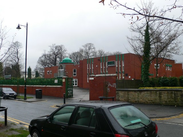
Photo: Eirian Evans, CC BY-SA 2.0.
Manchester Central Mosque and Islamic Cultural Centre is a mosque in Manchester, England. Sometimes referred to as Jamia Mosque, it is situated in the middle of Victoria Park, Manchester close to the Curry Mile. Manchester Central Mosque is situated 2,100 feet southwest of Victoria Park Centre.
Places in the Area
Nearby places include Longsight and Victoria Park.
Longsight
Suburb
Photo: Stemonitis, CC BY 2.5.
Longsight is an inner city area of Manchester, England, 3 miles south of the city centre, bounded by Ardwick and West Gorton to the north and east; Levenshulme to the south; and Chorlton-on-Medlock, Victoria Park and Fallowfield to the west.
Victoria Park
Quarter
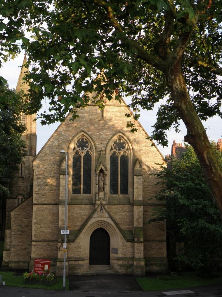
Photo: KGGucwa, CC BY-SA 3.0.
Victoria Park is a suburban area of Manchester, England. Victoria Park lies approximately two miles south of Manchester city centre, between Rusholme and Longsight.
Universities

Photo: francisco osorio, CC BY 2.0.
The Universities Corridor is in the south of Manchester. It covers the corridor around the Oxford Road and the Wilmslow Road, from the A57 south down through Rusholme to Fallowfield and the areas immediately either side bounded by the A34 and A5103.
Victoria Park Centre
- Type: Social service facility
- Address: 70 Daisy Bank Road, M14 5QN
- Category: building
- Location: Manchester, England, United Kingdom, Britain and Ireland, Europe
- View on OpenStreetMap
Latitude
53.45904° or 53° 27′ 33″ northLongitude
-2.21106° or 2° 12′ 40″ westOpen location code
9C5VFQ5Q+JHOpenStreetMap ID
way 569381749OpenStreetMap feature
amenity=social_facilityOpenStreetMap feature
building=yes
This page is based on OpenStreetMap, Wikidata, and Wikimedia Commons.
We’d love your help improving our open data sources. Thank you for contributing.
Satellite Map
Discover Victoria Park Centre from above in high-definition satellite imagery.
Notable Places Nearby
Highlights include Victoria Park Christian Fellowship and St. Joseph’s.
Nearby Places
Explore places such as Ripon House and Methodist International House.
Manchester: Must-Visit Destinations
Delve into Manchester Airport, Victoria-Shopping District, Piccadilly-East Centre, and Castlefield-Petersfield.
Curious Social Service Facilities to Discover
Uncover intriguing social service facilities from every corner of the globe.
About Mapcarta. Data © OpenStreetMap contributors and available under the Open Database License". Text is available under the CC BY-SA 4.0 license, except for photos, directions, and the map. Photo: David Dixon, CC BY-SA 2.0.