Xpress Stores
Xpress Stores is a convenience store in Norwich District, Norfolk, England which is located on Queens Road. Xpress Stores is situated nearby to the event venue St John the Theologian’s Church, as well as near the grassland Lady Julian Green.| Tap on a place to explore it |
Places of Interest Nearby
Highlights include Carrow Road and St John the Theologian’s Church.
Carrow Road
Stadium
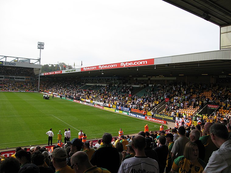
Photo: Mls11, Public domain.
Carrow Road is a football stadium in Norwich, Norfolk, England, and is the home of EFL Championship club Norwich City. The stadium is east of the city, near Norwich railway station and the River Wensum. Carrow Road is situated 2,100 feet east of Xpress Stores.
St John the Theologian’s Church
Event venue

Photo: Graham Hardy, CC BY-SA 2.0.
St John the Theologian's Church, Norwich is a Grade I listed parish church first part of the Church of England, then a Greek Orthodox Church, and finally to be re-opened again for secular use, in Norwich. It was also known as St John Sepulchre. St John the Theologian’s Church is situated 330 feet north of Xpress Stores.
Church of St Mark
Church

Photo: Graham Hardy, CC BY-SA 2.0.
Church of St Mark is situated 740 feet south of Xpress Stores.
Places in the Area
Nearby places include Norwich and Thorpe Hamlet.
Norwich

Photo: Ashley Dace, CC BY-SA 2.0.
Norwich, a two-cathedral city, is the capital of the English county of Norfolk, within the larger region of East Anglia. It lies some 185 km NNE of London, and as well as being a convenient base for exploring the Broads and the North Norfolk Coast is also…
Thorpe Hamlet
Suburb
Thorpe Hamlet is a suburb of Norwich, to the east of the city centre, in the Norwich District, in the English county of Norfolk. It was constituted a separate ecclesiastical parish on 9 March 1852, from the civil parish of Old Thorpe, and in 1912, was in the rural deanery of Blofield.
Golden Triangle
Locality
The Golden Triangle is a wedge-shaped area within the southwestern suburbs of Norwich, United Kingdom. The base of the Triangle is at the Colman Road stretch of the outer ring road, which is one mile southwest of the city's inner ring, with the other two sides – Earlham Road and Newmarket Road – pointing into the city centre.
Xpress Stores
- Type: Convenience store
- Address: 219 Queens Road, NR1 3AE
- Categories: building, shop, and food
- Location: Norwich District, Norfolk, East of England, England, United Kingdom, Britain and Ireland, Europe
- View on OpenStreetMap
Latitude
52.62074° or 52° 37′ 15″ northLongitude
1.30018° or 1° 18′ 1″ eastBrand
MaceOpen location code
9F43J8C2+73OpenStreetMap ID
way 569746816OpenStreetMap feature
building=yesOpenStreetMap feature
shop=convenience
This page is based on OpenStreetMap, Wikidata, and Wikimedia Commons.
We’d love your help improving our open data sources. Thank you for contributing.
Satellite Map
Discover Xpress Stores from above in high-definition satellite imagery.
Places with the Same Name
Discover other places named “Xpress Stores”.
Notable Places Nearby
Highlights include Lady Julian Green and St Mark’s Hall.
Nearby Places
Explore places such as Gold Scissors and Bom Sabor.
Norfolk: Must-Visit Destinations
Delve into Norwich, King’s Lynn, Great Yarmouth, and Norfolk Broads.
Curious Convenience Stores to Discover
Uncover intriguing convenience stores from every corner of the globe.
About Mapcarta. Data © OpenStreetMap contributors and available under the Open Database License". Text is available under the CC BY-SA 4.0 license, except for photos, directions, and the map. Photo: matthewhartley369, CC BY-SA 2.0.