Gut Waldeck
Gut Waldeck is a farm in Rhineland-Palatinate, Germany. Gut Waldeck is situated nearby to the hamlet Vogelstockerhof, as well as near the building Langenscheiderhof.| Tap on a place to explore it |
Places of Interest Nearby
Highlights include Langenscheiderhof and Orensberg.

Orensberg
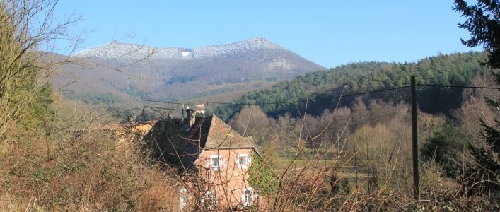
Peak

Photo: Steffen 962, CC0.
The Orensberg, also known in the region as the Orensfels due to the striking rock formations on its summit plateau, is a hill, 581.2 m above sea level, near Frankweiler in the county of Südliche Weinstraße in the German state of Rhineland-Palatinate. Orensberg is situated 2½ km northeast of Gut Waldeck.
Cistercian Monastery Church of St. Bernhard Eußerthal
Church

Photo: Gerd Eichmann, CC BY-SA 4.0.
Eusserthal Abbey was a Cistercian abbey in Eusserthal near Annweiler am Trifels in the Rhineland-Palatinate, Germany. All that now remains of it is the front portion of the abbey church, which is now used as a parish church. Cistercian Monastery Church of St. Bernhard Eußerthal is situated 2½ km northwest of Gut Waldeck.
Places in the Area
Nearby places include Vogelstockerhof and Queichhambach.

Dernbach
Village

Photo: Gerd Eichmann, CC BY-SA 4.0.
Dernbach is a municipality in the Südliche Weinstraße district, in Rhineland-Palatinate, Germany.
Gut Waldeck
- Type: Equestrianism
- Categories: farm, recreation area, and sports location
- Location: Rhineland-Palatinate, Germany, Central Europe, Europe
- View on OpenStreetMap
Latitude
49.23037° or 49° 13′ 49″ northLongitude
7.99745° or 7° 59′ 51″ eastOpen location code
8FX96XJW+4XOpenStreetMap ID
way 572549717OpenStreetMap feature
landuse=farmyardOpenStreetMap feature
leisure=horse_riding
This page is based on OpenStreetMap, Wikidata, and Wikimedia Commons.
We’d love your help improving our open data sources. Thank you for contributing.
Satellite Map
Discover Gut Waldeck from above in high-definition satellite imagery.
Places with the Same Name
Discover other places named “Gut Waldeck”.
Notable Places Nearby
Highlights include Biosphärenreservat Pfälzerwald - Kernzone - Eischkopf and Rothen-Kopf.
Nearby Places
Explore places such as Albersweiler, Am Vogelstock and Am Vogelstock.
Rhineland-Palatinate: Must-Visit Destinations
Delve into Mainz, Trier, Koblenz, and Worms.
Curious Places to Discover
Uncover intriguing places from every corner of the globe.
About Mapcarta. Data © OpenStreetMap contributors and available under the Open Database License". Text is available under the CC BY-SA 4.0 license, except for photos, directions, and the map. Photo: Traveler100, CC BY-SA 3.0.