Périgny TH009
Périgny TH009 is a house in Couvin, Arrondissement de Philippeville, Wallonia. Périgny TH009 is situated nearby to the garden Tyrol, as well as near the fountain Lavoir Bayard.| Tap on a place to explore it |
Places of Interest Nearby
Highlights include Neptune Caves and Couvin railway station.
Neptune Caves
Cave
The Neptune Caves, also known as the Grottes de l'Adugeoir are a series of natural caves located in Wallonia near Petigny in the municipality of Couvin, Belgium. Neptune Caves is situated 1½ km northwest of Périgny TH009.
Couvin railway station
Railway station

Photo: Smith.conrad, CC0.
Couvin railway station is situated 2½ km west of Périgny TH009.
Maison des Baillis
Castle
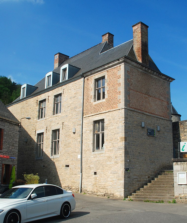
Photo: EmDee, CC BY-SA 3.0.
Maison des Baillis is a castle, which is situated 2½ km northeast of Périgny TH009.
Places in the Area
Nearby places include Petigny and Nismes.

Nismes
Village

Photo: Jean-Pol GRANDMONT, CC BY 3.0.
Nismes is a village, which is situated 2½ km northeast of Périgny TH009.
Frasnes-lez-Couvin
Village

Photo: 1959jph, CC BY-SA 3.0.
Frasnes-lez-Couvin is a village, which is situated 3 km northwest of Périgny TH009.
Périgny TH009
- Type: House
- Categories: building and residential building
- Location: Couvin, Arrondissement de Philippeville, Namur, Wallonia, Belgium, Benelux, Europe
- View on OpenStreetMap
Latitude
50.0538° or 50° 3′ 14″ northLongitude
4.52886° or 4° 31′ 44″ eastOpen location code
9F263G3H+GGOpenStreetMap ID
way 572839250OpenStreetMap feature
building=house
This page is based on OpenStreetMap, Wikidata, and Wikimedia Commons.
We’d love your help improving our open data sources. Thank you for contributing.
Satellite Map
Discover Périgny TH009 from above in high-definition satellite imagery.
Notable Places Nearby
Highlights include Tyrol and Lavoir Bayard.
Nearby Places
Explore places such as Périgny TH009 and La Roseraie.
Curious Houses to Discover
Uncover intriguing houses from every corner of the globe.
About Mapcarta. Data © OpenStreetMap contributors and available under the Open Database License". Text is available under the CC BY-SA 4.0 license, except for photos, directions, and the map. Photo: BUFO88, CC BY-SA 3.0.