Loenermark
Loenermark is a pitch in Apeldoorn Municipality, Gelderland. Loenermark is situated nearby to the community center Scoutinggroep Valeouwe, as well as near the sports venue Sportpark Lonapark.| Tap on a place to explore it |
Places of Interest Nearby
Highlights include Huis Ter Horst and Station Loenen.
Huis Ter Horst
House
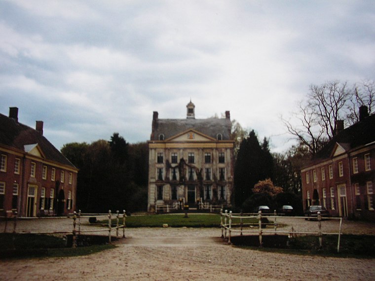
Photo: Gijsevers, CC BY-SA 3.0.
Huis Ter Horst is a house, which is situated 220 metres northeast of Loenermark.
Station Loenen
Railway station
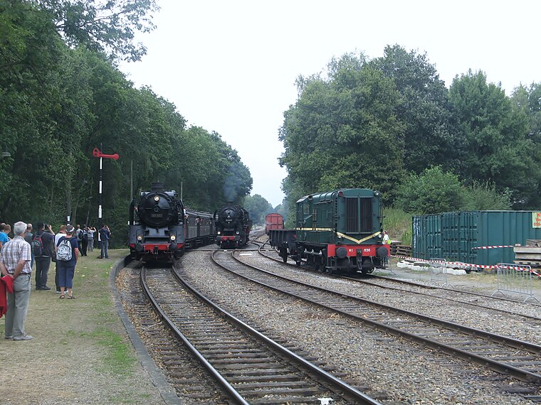
Photo: CrabbyPatrick, CC BY 3.0.
Station Loenen is a railway station, which is situated 720 metres north of Loenermark.
De Middelste Molen, Loenen
Museum

Photo: Quistnix, CC BY-SA 2.5.
De Middelste Molen, Loenen is a museum, which is situated 1½ km northeast of Loenermark.
Places in the Area
Nearby places include Loenen and Eerbeek.
Loenen
Village

Photo: Wikimedia, CC BY-SA 4.0.
Loenen is a village in the Dutch province of Gelderland. It is located in the municipality of Apeldoorn, about 10 km southeast of that city. Loenen was a separate municipality until 1818, when it was merged with Apeldoorn.
Eerbeek
Village
Eerbeek is a town in the municipality of Brummen in the province of Gelderland in the Netherlands. Eerbeek was first mentioned in 1046 as Erbeke. In the 18th century, Eerbeek became a centre of paper production. Eerbeek is situated 3½ km southeast of Loenermark.
Lieren
Village

Photo: Koosg, CC BY-SA 3.0.
Lieren is a village in the Netherlands and part of the municipality of Apeldoorn. It is situated about 8 km south-east of the city centre of Apeldoorn and 2 km east of Beekbergen. Lieren is situated 5 km northwest of Loenermark.
Loenermark
- Type: Pitch
- Categories: recreation area, football, and sports location
- Location: Apeldoorn Municipality, Gelderland, Eastern Netherlands, Netherlands, Benelux, Europe
- View on OpenStreetMap
Latitude
52.12298° or 52° 7′ 23″ northLongitude
6.02725° or 6° 1′ 38″ eastOpen location code
9F4842FG+5VOpenStreetMap ID
way 60469550OpenStreetMap feature
leisure=pitchOpenStreetMap feature
sport=soccer
This page is based on OpenStreetMap, Wikidata, and Wikimedia Commons.
We’d love your help improving our open data sources. Thank you for contributing.
Satellite Map
Discover Loenermark from above in high-definition satellite imagery.
Places with the Same Name
Discover other places named “Loenermark”.
Notable Places Nearby
Highlights include Sportpark Lonapark and Scoutinggroep Valeouwe.
Nearby Places
Explore places such as Mahpita Tanpa and Stal de Brouwerij.
Gelderland: Must-Visit Destinations
Delve into Arnhem, Nijmegen, Ede, and Zutphen.
Curious Pitches to Discover
Uncover intriguing pitches from every corner of the globe.
About Mapcarta. Data © OpenStreetMap contributors and available under the Open Database License". Text is available under the CC BY-SA 4.0 license, except for photos, directions, and the map. Photo: Agnes Monkelbaan, CC BY-SA 4.0.