Campo de Petanca Andrés Bielsa Vicente
Campo de Petanca Andrés Bielsa Vicente is a pitch in Talavera de la Reina, Toledo, Castile-La Mancha. Campo de Petanca Andrés Bielsa Vicente is situated nearby to Fuente de las Ranas, Talavera de la Reina, as well as near the park Parque de la Alameda, Talavera de la Reina.| Tap on a place to explore it |
Places of Interest Nearby
Highlights include Parque de la Alameda, Talavera de la Reina and Basilica of Nuestra Señora del Prado.
Parque de la Alameda, Talavera de la Reina
Park

Photo: Javiergil73, CC BY-SA 3.0.
Parque de la Alameda, Talavera de la Reina is a park, which is situated 180 metres southeast of Campo de Petanca Andrés Bielsa Vicente.
Basilica of Nuestra Señora del Prado
Church

Photo: Javiergil73, CC BY-SA 3.0.
The Basilica of Nuestra Señora del Prado is a Roman Catholic basilica in Talavera de la Reina, Spain. Basilica of Nuestra Señora del Prado is situated 200 metres east of Campo de Petanca Andrés Bielsa Vicente.
Fuente de las Ranas, Talavera de la Reina
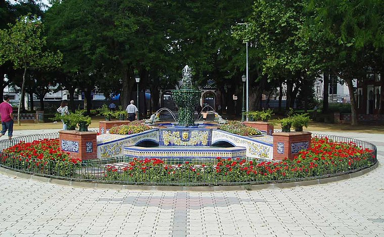
Photo: Javierg, CC BY-SA 3.0.
Fuente de las Ranas, Talavera de la Reina is situated 160 metres northwest of Campo de Petanca Andrés Bielsa Vicente.
Places in the Area
Nearby places include Talavera de la Reina and Talavera la Nueva.

Talavera la Nueva
Village
 Talavera la Nueva is an EATIM belonging to the municipality of Talavera de la Reina, Spain. Talavera la Nueva is situated 7 km southwest of Campo de Petanca Andrés Bielsa Vicente.
Mejorada
Village

Photo: Benjamín Núñez González, CC BY-SA 4.0.
Mejorada is a village located in the province of Toledo, Castile-La Mancha, Spain. According to the 2017 census, the municipality has a population of 2,809 inhabitants. Mejorada is situated 7 km northwest of Campo de Petanca Andrés Bielsa Vicente.
Campo de Petanca Andrés Bielsa Vicente
- Type: Pitch
- Categories: recreation area, bocce, and sports location
- Location: Talavera de la Reina, Toledo, Castile-La Mancha, Central Spain, Spain, Iberia, Europe
- View on OpenStreetMap
Latitude
39.96091° or 39° 57′ 39″ northLongitude
-4.823° or 4° 49′ 23″ westOpen location code
8CFQX56G+9ROpenStreetMap ID
way 609924704OpenStreetMap feature
leisure=pitchOpenStreetMap feature
sport=boules
This page is based on OpenStreetMap, Wikidata, and Wikimedia Commons.
We’d love your help improving our open data sources. Thank you for contributing.
Satellite Map
Discover Campo de Petanca Andrés Bielsa Vicente from above in high-definition satellite imagery.
Notable Places Nearby
Highlights include La Mezquita and Clínica Marazuela.
Nearby Places
Explore places such as Jaula de los Pavos Reales and El jardín de Pigmalion.
Castile-La Mancha: Must-Visit Destinations
Delve into Toledo, Albacete, Cuenca, and Ciudad Real.
Curious Pitches to Discover
Uncover intriguing pitches from every corner of the globe.
About Mapcarta. Data © OpenStreetMap contributors and available under the Open Database License". Text is available under the CC BY-SA 4.0 license, except for photos, directions, and the map. Photo: Diliff, CC BY-SA 3.0.