Terrain multisports de Houdan
Terrain multisports de Houdan is a pitch in Houdan, Arrondissement of Mantes-la-Jolie, Île-de-France. Terrain multisports de Houdan is situated nearby to the sports venue Gymnase de Houdan, as well as near the playground Aire de jeux pour enfants.| Tap on a place to explore it |
Places of Interest Nearby
Highlights include Donjon de Houdan and Gare de Houdan.
Donjon de Houdan

Photo: Henrysalome, CC BY 2.5.
The Donjon de Houdan is a medieval fortified tower in the commune of Houdan in the Yvelines département of France. Donjon de Houdan is situated 620 metres southwest of Terrain multisports de Houdan.
Gare de Houdan
Railway station
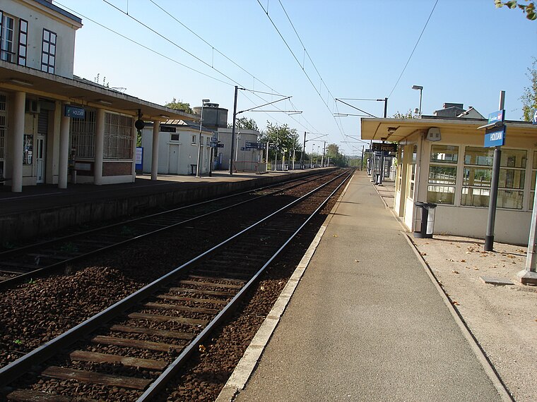
Photo: Parisdreux, CC BY-SA 3.0.
Gare de Houdan is a railway station, which is situated 590 metres northwest of Terrain multisports de Houdan.
Saint-Jacques et Saint-Christophe church
Church

Photo: Henrysalome, CC BY 2.5.
Saint-Jacques et Saint-Christophe church is situated 450 metres southwest of Terrain multisports de Houdan.
Places in the Area
Nearby places include Houdan and Berchères-sur-Vesgre.
Houdan
Village

Photo: Coyau, CC BY-SA 3.0.
Houdan is a commune of the Yvelines department 63 kilometres west of Paris in the north of France.
Berchères-sur-Vesgre
Village

Photo: Rivolion, CC BY-SA 3.0.
Berchères-sur-Vesgre is a commune in the Eure-et-Loir department in northern France. Berchères-sur-Vesgre is situated 7 km northwest of Terrain multisports de Houdan.
Bû
Village

Photo: GFreihalter, CC BY-SA 3.0.
Bû is a commune in the Eure-et-Loir department in northern France. Bû is situated 8 km west of Terrain multisports de Houdan.
Terrain multisports de Houdan
- Type: Pitch
- Categories: recreation area and sports location
- Location: Houdan, Arrondissement of Mantes-la-Jolie, Yvelines, Île-de-France, France, Europe
- View on OpenStreetMap
Latitude
48.79143° or 48° 47′ 29″ northLongitude
1.60689° or 1° 36′ 25″ eastOpen location code
8FW3QJR4+HQOpenStreetMap ID
way 612595557OpenStreetMap feature
leisure=pitchOpenStreetMap feature
sport=soccerOpenStreetMap feature
sport=basketballOpenStreetMap feature
sport=handball
This page is based on OpenStreetMap, Wikidata, and Wikimedia Commons.
We’d love your help improving our open data sources. Thank you for contributing.
Satellite Map
Discover Terrain multisports de Houdan from above in high-definition satellite imagery.
Notable Places Nearby
Highlights include Gymnase de Houdan and Aire de jeux pour enfants.
Nearby Places
Explore places such as Parking du gymnase and Tennis club houdan.
Île-de-France: Must-Visit Destinations
Delve into Paris, Versailles, Boulogne-Billancourt, and Paris Charles de Gaulle Airport.
Curious Pitches to Discover
Uncover intriguing pitches from every corner of the globe.
About Mapcarta. Data © OpenStreetMap contributors and available under the Open Database License". Text is available under the CC BY-SA 4.0 license, except for photos, directions, and the map. Photo: Inkey, CC BY-SA 3.0.