School of Industrial Design, Engineering and Art
School of Industrial Design, Engineering and Art is a school in Pierce, Washington. School of Industrial Design, Engineering and Art is situated nearby to the church Living Word Ministries, as well as near Saint Ann Catholic Church.| Tap on a place to explore it |
Places of Interest Nearby
Highlights include Fire Station No. 10 and South Tacoma station.
Fire Station No. 10
Fire station

Photo: Murderbike, Public domain.
Fire Station No. 10 is a fire station located at 7247 S Park Avenue in Tacoma, Washington. The station was designed by architect Morton J. Nicholson and built by Martin H. Fire Station No. 10 is situated 2,100 feet south of School of Industrial Design, Engineering and Art.
South Tacoma station
Railway station
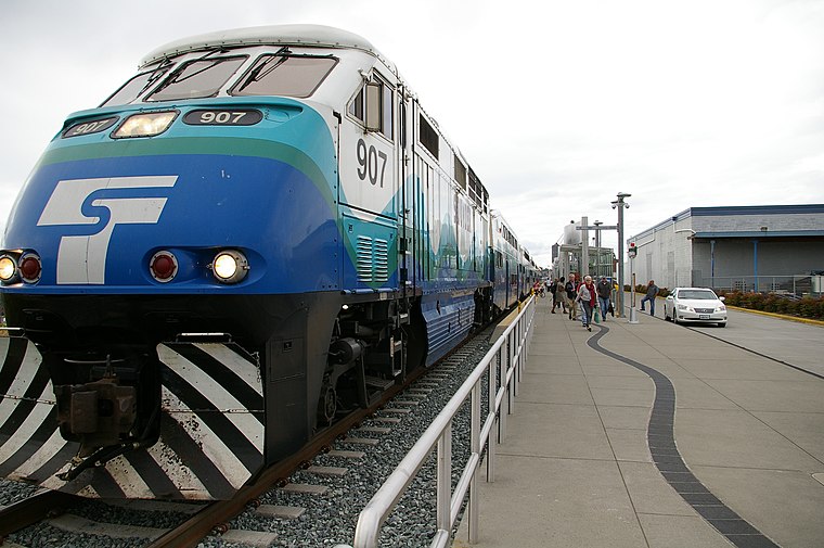
Photo: Kgrr, CC BY-SA 3.0.
South Tacoma station is a commuter rail station in Tacoma, Washington, United States, served by the S Line of the Sounder commuter rail network. It is located near the Tacoma Mall along South Tacoma Way at South 56th Street and consists of a single platform and a 220-stall park-and-ride lot. South Tacoma station is situated 2 miles west of School of Industrial Design, Engineering and Art.
Tacoma Mall
Shopping center
The Tacoma Mall is the largest shopping center in Tacoma, Washington, United States, and is owned and operated by the Simon Property Group. Anchor tenants include Dick's Sporting Goods, JCPenney, Macy's, and Nordstrom, with one vacant and demolished anchor last occupied by Sears, which opened in 1981. Tacoma Mall is situated 2 miles northwest of School of Industrial Design, Engineering and Art.
Places in the Area
Nearby places include Fern Hill and Lincoln International District.
Fern Hill
Quarter

Photo: Visitor7, CC BY-SA 3.0.
Fern Hill is a neighborhood located in the southern part of Tacoma, Washington, United States. It is generally defined as extending west from the intersection of S 84th and Pacific Avenue to South Thompson St.
Lincoln International District
Neighborhood
The Lincoln International Business District is a neighborhood in Tacoma, Washington, near historic Lincoln High School. Centered on S. 38th St and Yakima, the Lincoln International District is home to the majority of Tacoma's Vietnamese businesses and community centers. Lincoln International District is situated 2 miles north of School of Industrial Design, Engineering and Art.
Salishan
Neighborhood
Salishan is a neighborhood of Tacoma, Washington that was originally created as a World War II housing project but, starting in 2002, has been demolished and rebuilt into a new neighborhood of homes, apartments, services, and parks on new infrastructure. Salishan is situated 2 miles northeast of School of Industrial Design, Engineering and Art.
School of Industrial Design, Engineering and Art
- Type: School
- Also known as: “IDEA High School”
- Category: education
- Location: Pierce, Washington, Pacific Northwest, United States, North America
- View on OpenStreetMap
Latitude
47.19604° or 47° 11′ 46″ northLongitude
-122.44056° or 122° 26′ 26″ westElevation
387 feet (118 metres)Open location code
84VV5HW5+CQOpenStreetMap ID
way 617876881OpenStreetMap feature
amenity=school
This page is based on OpenStreetMap, Wikidata, and Wikimedia Commons.
We’d love your help improving our open data sources. Thank you for contributing.
Satellite Map
Discover School of Industrial Design, Engineering and Art from above in high-definition satellite imagery.
Notable Places Nearby
Highlights include Living Word Ministries and Saint Ann Catholic Church.
Nearby Places
Explore places such as Yakima Avenue South & South 68th Street and MultiCare.
Washington: Must-Visit Destinations
Delve into Seattle, Olympia, Tacoma, and Spokane.
Curious Schools to Discover
Uncover intriguing schools from every corner of the globe.
About Mapcarta. Data © OpenStreetMap contributors and available under the Open Database License". Text is available under the CC BY-SA 4.0 license, except for photos, directions, and the map. Photo: Lumpytrout, CC BY-SA 3.0.