Skate Plaza
Skate Plaza is a pitch in Community of Madrid, Central Spain. Skate Plaza is situated nearby to the pitch Campo de fútbol ‘Rodríguez Sahagún’, as well as near the bridge Acueducto de Valdeacederas.| Tap on a place to explore it |
Places of Interest Nearby
Highlights include Antonio Machado and Valdezarza.
Antonio Machado
Metro station
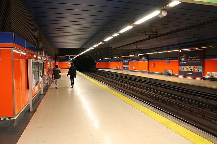
Photo: Draceane, CC BY-SA 4.0.
Antonio Machado is a station on Line 7 of the Madrid Metro, near the Calle de Antonio Machado. It is located in fare Zone A. This station close to the street of the same name, in the Valdezarza neighborhood. Antonio Machado is situated 700 metres west of Skate Plaza.
Valdezarza
Metro station

Photo: Draceane, CC BY-SA 4.0.
Valdezarza is a station on Line 7 of the Madrid Metro, serving the Valdezarza barrio. It is located in fare Zone A. Valdezarza is situated 800 metres southwest of Skate Plaza.
Peñagrande
Metro station

Photo: Draceane, CC BY-SA 4.0.
Peñagrande is a station on Line 7 of the Madrid Metro, serving the barrio of Peñagrande. It is located in fare Zone A. Peñagrande is situated 1 km northwest of Skate Plaza.
Places in the Area
Nearby places include Valdeacederas and El Pilar.
Valdeacederas
Quarter

Photo: Ricardo Ricote Rodríguez, CC BY 2.0.
Valdeacederas is an administrative neighborhood of Madrid belonging to the district of Tetuán.
El Pilar
Quarter

Photo: Ricardo Ricote Rodrí…, CC BY 3.0.
El Pilar is a ward of Madrid, the capital of Spain, belonging to the district of Fuencarral-El Pardo.
Valdezarza
Quarter

Photo: Malopez 21, CC BY-SA 4.0.
Valdezarza is an administrative neighborhood of Madrid belonging to the district of Moncloa-Aravaca.
Skate Plaza
- Type: Pitch
- Categories: skateboard, recreation area, and sports location
- Location: Community of Madrid, Central Spain, Spain, Iberia, Europe
- View on OpenStreetMap
Latitude
40.46983° or 40° 28′ 11″ northLongitude
-3.7096° or 3° 42′ 35″ westOpen location code
8CGRF79R+W5OpenStreetMap ID
way 6181508OpenStreetMap feature
leisure=pitchOpenStreetMap feature
sport=skateboard
This page is based on OpenStreetMap, Wikidata, and Wikimedia Commons.
We’d love your help improving our open data sources. Thank you for contributing.
Satellite Map
Discover Skate Plaza from above in high-definition satellite imagery.
Places with the Same Name
Discover other places named “Skate Plaza”.
Notable Places Nearby
Highlights include Campo de fútbol ‘Rodríguez Sahagún’ and Acueducto de Valdeacederas.
Nearby Places
Explore places such as Skyline Madrid and Jeep.
Community of Madrid: Must-Visit Destinations
Delve into Madrid, Alcalá de Henares, Getafe, and Aranjuez.
Curious Pitches to Discover
Uncover intriguing pitches from every corner of the globe.
About Mapcarta. Data © OpenStreetMap contributors and available under the Open Database License". Text is available under the CC BY-SA 4.0 license, except for photos, directions, and the map. Photo: Wikimedia, CC0.