Yelverton Surgery
Yelverton Surgery is a building in Buckland Monachorum, West Devon District, England. Yelverton Surgery is situated nearby to the pub Rock Inn, as well as near Yelverton Post Office.| Tap on a place to explore it |
Places of Interest Nearby
Highlights include Church of St Paul and Burrator Inn.
Church of St Paul
Church

Photo: Andrew Hackney, CC BY-SA 2.0.
Church of St Paul is situated 800 feet southwest of Yelverton Surgery.
Burrator Inn
Pub

Photo: Andrew Hackney, CC BY-SA 2.0.
Burrator Inn is a pub, which is situated 1 mile northeast of Yelverton Surgery.
Royal Oak Inn
Pub

Photo: Martin Bodman, CC BY-SA 2.0.
Royal Oak Inn is a pub, which is situated 1¼ miles east of Yelverton Surgery.
Places in the Area
Nearby places include Yelverton and Roborough Rock.
Yelverton
Village
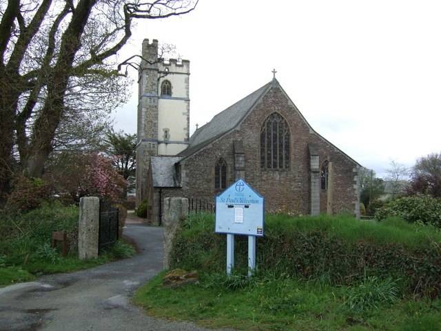
Photo: JThomas, CC BY-SA 2.0.
Yelverton is a large village on the south-western edge of Dartmoor, Devon, in England. It is in the civil parish of Buckland Monachorum. According to the 2021 census, it had a population of 1,858, which was slightly more than the 1,810 recorded at the 2011 census.
Roborough Rock
Locality

Photo: Mark Land, CC BY-SA 2.0.
Yelverton Rock is a tor-like igneous rock outcrop immediately south-west of Yelverton, Devon. It is located at the southern end of the former RAF Harrowbeer airfield on Roborough Down, next to the border with the A386.
Dousland
Village
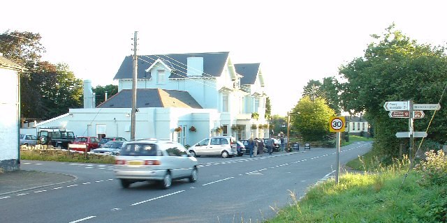
Photo: Pete Chapman, CC BY-SA 2.0.
Dousland is a small settlement in Devon, England. It is near the A386 road at Yelverton and is 10 kilometres northeast of the city of Plymouth - 10 kilometres by road.
Yelverton Surgery
- Type: Health care
- Category: building
- Location: Buckland Monachorum, West Devon District, Devon, West Country, England, United Kingdom, Britain and Ireland, Europe
- View on OpenStreetMap
Latitude
50.49222° or 50° 29′ 32″ northLongitude
-4.08396° or 4° 5′ 2″ westOpen location code
9C2QFWR8+VCOpenStreetMap ID
way 622137650OpenStreetMap feature
building=yesOpenStreetMap feature
healthcare=yes
This page is based on OpenStreetMap, Wikidata, and Wikimedia Commons.
We’d love your help improving our open data sources. Thank you for contributing.
Satellite Map
Discover Yelverton Surgery from above in high-definition satellite imagery.
Notable Places Nearby
Highlights include Rock Inn and Yelverton Post Office.
Nearby Places
Explore places such as Texaco and Bidders.
Devon: Must-Visit Destinations
Delve into Plymouth, Exeter, Torquay, and Barnstaple.
Curious Places to Discover
Uncover intriguing places from every corner of the globe.
About Mapcarta. Data © OpenStreetMap contributors and available under the Open Database License". Text is available under the CC BY-SA 4.0 license, except for photos, directions, and the map. Photo: matthewhartley369, CC BY-SA 2.0.