Be More Outdoors Horse Field
Be More Outdoors Horse Field is a recreation area in Kirklees, England. Be More Outdoors Horse Field is situated nearby to the bridge Slaithwaite Viaduct, as well as near the garden Orchard.| Tap on a place to explore it |
Places of Interest Nearby
Highlights include Slaithwaite railway station and Slaithwaite Viaduct.
Slaithwaite railway station
Railway station
 Slaithwaite railway station serves the town of Slaithwaite, West Yorkshire, England. The station is 4 miles west of Huddersfield railway station on the Huddersfield Line between Huddersfield and Manchester Victoria. Slaithwaite railway station is situated 2,300 feet northeast of Be More Outdoors Horse Field.
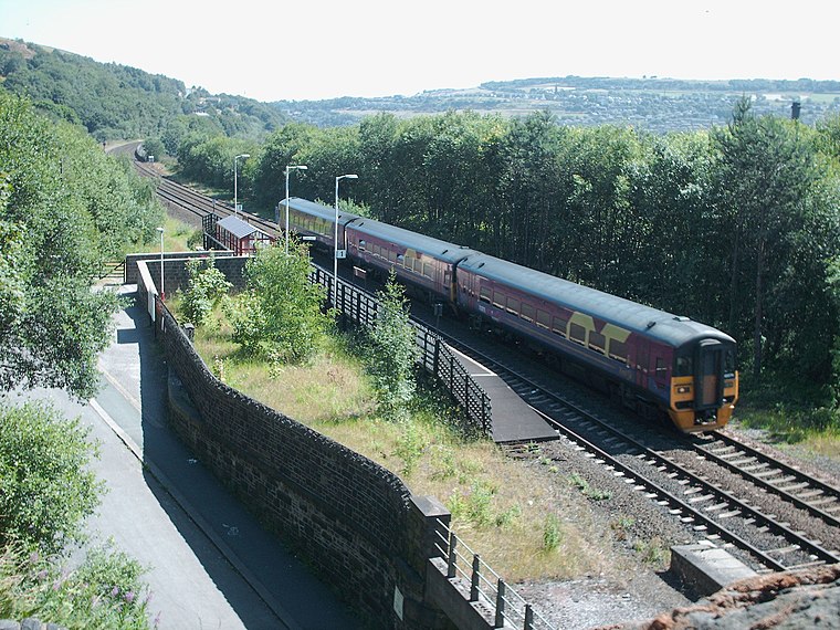
Slaithwaite Viaduct
Bridge

Photo: Betty Longbottom, CC BY-SA 2.0.
Slaithwaite Viaduct is a bridge, which is situated 1,400 feet northeast of Be More Outdoors Horse Field.
Shoulder Of Mutton
Pub

Photo: Pamela Norrington, CC BY-SA 2.0.
Shoulder Of Mutton is a pub, which is situated 1,600 feet northeast of Be More Outdoors Horse Field.
Places in the Area
Nearby places include Slaithwaite and Wilberlee.
Slaithwaite
Village
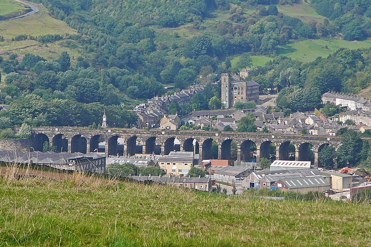 Slaithwaite is a town in the Kirklees district of West Yorkshire, England. Historically part of the West Riding of Yorkshire, it is in the Colne Valley and on the Huddersfield Narrow Canal, 5 miles south-west of Huddersfield.
Wilberlee
Hamlet

Photo: Pamela Norrington, CC BY-SA 2.0.
Wilberlee is a hamlet in the Colne Valley, in the Kirklees district, in the county of West Yorkshire, England. It is near the town of Huddersfield and the village of Slaithwaite. Wilberlee has a school called Wilberlee Junior and Infant School.

Be More Outdoors Horse Field
- Type: Equestrianism
- Also known as: “Babes in the Woods Family Forest School”
- Categories: recreation area and sports location
- Location: Kirklees, England, United Kingdom, Britain and Ireland, Europe
- View on OpenStreetMap
Latitude
53.61963° or 53° 37′ 11″ northLongitude
-1.88824° or 1° 53′ 18″ westOpen location code
9C5WJ496+RPOpenStreetMap ID
way 624273257OpenStreetMap feature
leisure=horse_riding
This page is based on OpenStreetMap, Wikidata, and Wikimedia Commons.
We’d love your help improving our open data sources. Thank you for contributing.
Satellite Map
Discover Be More Outdoors Horse Field from above in high-definition satellite imagery.
Notable Places Nearby
Highlights include Orchard and Slaithwaite Community Centre.
Nearby Places
Explore places such as Slaithwaite, Manchester Road / adjacent Lingards Road and Slaithwaite, Manchester Road / opposite Lingards Road.
England: Must-Visit Destinations
Delve into London, Manchester, Sheffield, and Leeds.
Curious Places to Discover
Uncover intriguing places from every corner of the globe.
About Mapcarta. Data © OpenStreetMap contributors and available under the Open Database License". Text is available under the CC BY-SA 4.0 license, except for photos, directions, and the map. Photo: sidibousaid, CC BY 2.0.