Usine de Clichy
Usine de Clichy is in Clichy, Arrondissement of Nanterre, Île-de-France. Usine de Clichy is situated nearby to the fire station Centre de secours de Clichy, as well as near the park Parc Robinson.| Tap on a place to explore it |
Places of Interest Nearby
Highlights include Cimetière des Chiens et Autres Animaux Domestiques and Château d’Asnières.
Cimetière des Chiens et Autres Animaux Domestiques
Cemetery
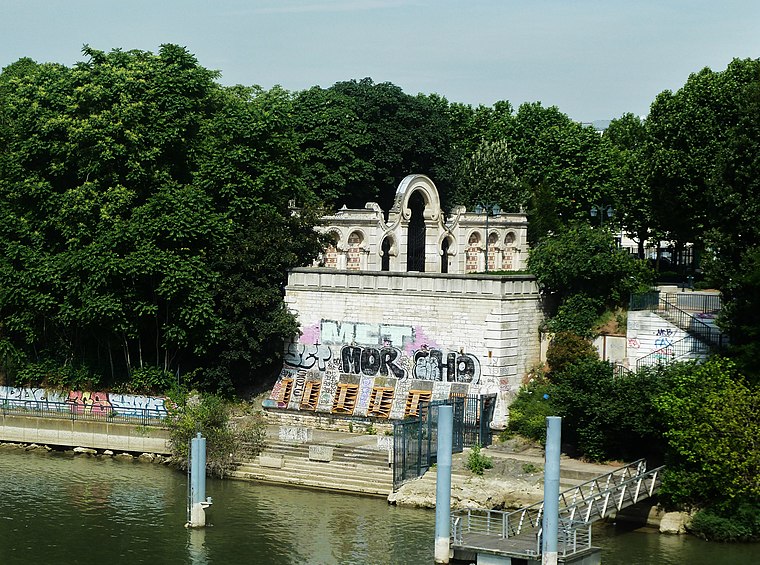
Photo: Wowo2008, CC BY-SA 3.0.
The Cimetière des Chiens et Autres Animaux Domestiques is often claimed to be the first zoological necropolis in the modern world. The ancient Ashkelon dog cemetery predates it by thousands of years. Cimetière des Chiens et Autres Animaux Domestiques is situated 320 metres north of Usine de Clichy.
Château d’Asnières
Museum

Photo: Wikimedia, CC BY-SA 3.0.
The château d’Asnières is a stately home at 89 rue du Château in the town of Asnières-sur-Seine in Hauts-de-Seine, France. Château d’Asnières is situated 520 metres northwest of Usine de Clichy.
Parc Robinson
Park

Photo: Gérald Garitan, CC BY-SA 4.0.
Parc Robinson is a park, which is situated 310 metres northwest of Usine de Clichy.
Places in the Area
Nearby places include Clichy and Asnières-sur-Seine.
Clichy
Town

Photo: Parisette, CC BY-SA 3.0.
Clichy is a commune in the northwestern suburbs of Paris, France. It is located on the Seine, 6.4 km from the centre of Paris. Located in Clichy are the headquarters of the L'Oréal Group, the world's largest company in cosmetics and beauty; Bic, one of the biggest pen producers in the world; Monoprix, a major French retail chain; as well as Sony France, a large electronics and media company.
Asnières-sur-Seine
Town

Photo: Brumathechec, CC BY-SA 4.0.
Asnières-sur-Seine is a commune in the Hauts-de-Seine department in the Île-de-France region of northern France. It lies on the left bank of the river Seine, some eight kilometres from the centre of Paris in the northwestern suburbs of the French capital.

Usine de Clichy
- Type: Industry
- Location: Clichy, Arrondissement of Nanterre, Hauts-de-Seine, Île-de-France, France, Europe
- View on OpenStreetMap
Latitude
48.90675° or 48° 54′ 24″ northLongitude
2.29776° or 2° 17′ 52″ eastOperator
SIAAPOpen location code
8FW4W74X+M4OpenStreetMap ID
way 626858777OpenStreetMap feature
landuse=industrial
This page is based on OpenStreetMap, Wikidata, and Wikimedia Commons.
We’d love your help improving our open data sources. Thank you for contributing.
Satellite Map
Discover Usine de Clichy from above in high-definition satellite imagery.
Notable Places Nearby
Highlights include Centre de secours de Clichy and Palomano City.
Nearby Places
Explore places such as Hertz and Rue du Port.
Île-de-France: Must-Visit Destinations
Delve into Paris, Versailles, Boulogne-Billancourt, and Paris Charles de Gaulle Airport.
Curious Places to Discover
Uncover intriguing places from every corner of the globe.
About Mapcarta. Data © OpenStreetMap contributors and available under the Open Database License". Text is available under the CC BY-SA 4.0 license, except for photos, directions, and the map. Photo: Clicsouris, CC BY-SA 2.5.