Basis@Sunderland
Basis@Sunderland is a church in Sunderland, England which is located on Park Road. Basis@Sunderland is situated nearby to the building Bede Tower, as well as near Bethany City Church.| Tap on a place to explore it |
- Opening hours: Monday—Friday 9:00 AM—2:00 PM
- Type: Church
- Address: Park Road, Sunderland, SR2 8HR
Places of Interest Nearby
Highlights include Mowbray Park and Stadium of Light.
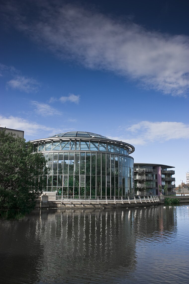
Mowbray Park
Park

Photo: Craigy144, CC BY-SA 3.0.
Mowbray Park is a municipal park in the centre of Sunderland, Tyne and Wear, England, located a few hundred yards from the busy thoroughfares of Holmeside and Fawcett Street and bordered by Sunderland Museum and Winter Gardens to the north, Burdon Road to the west, Toward Road to the east and Park Road to the south. Mowbray Park is situated 890 feet north of Basis@Sunderland.
Stadium of Light
Stadium

Photo: Blackcat, CC BY-SA 4.0.
The Stadium of Light is an all-seater football stadium in Sunderland, England, and the eighth and current home to Sunderland. With space for 49,000 spectators, the Stadium of Light is the 10th largest football stadium in England. Stadium of Light is situated 1 mile north of Basis@Sunderland.
Sunderland Museum and Winter Gardens
Museum
 Sunderland Museum and Winter Gardens is a municipal museum in Sunderland, England. It contains the only known British example of a gliding reptile, the oldest known vertebrate capable of gliding flight. Sunderland Museum and Winter Gardens is situated 1,600 feet north of Basis@Sunderland.
Places in the Area
Nearby places include Ashbrooke and Grangetown.
Ashbrooke
Suburb
Ashbrooke is a residential area of Sunderland, North East England directly south and south-west of the city centre. Ashbrooke developed through the Victorian era as Sunderland's first suburb.
Grangetown
Suburb
Grangetown is a suburb of the City of Sunderland, in Tyne and Wear, England. Grangetown, which is an area within the Hendon Metropolitan District, was part of the Sunderland South parliamentary constituency for elections to the House of Commons of the United Kingdom, but in 2010 was made a ward of the new Sunderland Central parliamentary constituency.
Monkwearmouth
Suburb

Photo: R J McNaughton, CC BY-SA 2.0.
Monkwearmouth is an area of Sunderland, Tyne and Wear in England. Monkwearmouth is located at the north side of the mouth of the River Wear. It was one of the three original settlements on the banks of the River Wear along with Bishopwearmouth and Sunderland.
Basis@Sunderland
- Categories: building, office, charitable organization, and religion
- Location: Sunderland, England, United Kingdom, Britain and Ireland, Europe
- View on OpenStreetMap
Latitude
54.89974° or 54° 53′ 59″ northLongitude
-1.38116° or 1° 22′ 52″ westOpen location code
9C6WVJX9+VGOpenStreetMap ID
way 636223892OpenStreetMap feature
building=churchOpenStreetMap feature
office=charity
This page is based on OpenStreetMap, Wikidata, and Wikimedia Commons.
We’d love your help improving our open data sources. Thank you for contributing.
Satellite Map
Discover Basis@Sunderland from above in high-definition satellite imagery.
Notable Places Nearby
Highlights include Bede Tower and Bethany City Church.
Nearby Places
Explore places such as BURDON ROAD-BEDE PLACE-S/B and Wearside Masonic Hall.
England: Must-Visit Destinations
Delve into London, Manchester, Sheffield, and Leeds.
Curious Churches to Discover
Uncover intriguing churches from every corner of the globe.
About Mapcarta. Data © OpenStreetMap contributors and available under the Open Database License". Text is available under the CC BY-SA 4.0 license, except for photos, directions, and the map. Photo: AlasdairW, CC BY-SA 3.0.