Stone Cross Farm
Stone Cross Farm is a residential area in Laughton, Wealden District, England. Stone Cross Farm is situated nearby to the forest Bowen Wood, as well as near Laughton Common Wood.| Tap on a place to explore it |
Places of Interest Nearby
Highlights include The Parish Church of All Saints, Laughton and Farleys House.
The Parish Church of All Saints, Laughton
Church

Photo: Kevin Gordon, CC BY-SA 2.0.
The Parish Church of All Saints, Laughton is situated 3,700 feet west of Stone Cross Farm.
Farleys House
Museum
Farleys House near Chiddingly, East Sussex, England, has been converted into a museum and archive featuring the lives and work of its former residents, the photographer Lee Miller and the surrealist artist Roland Penrose. Farleys House is situated 2 miles east of Stone Cross Farm.
The Parish Church of St John the Baptist
Church
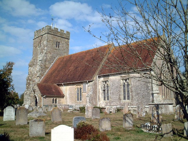
Photo: Pauline Kennard, CC BY-SA 2.0.
The Parish Church of St John the Baptist is situated 1½ miles south of Stone Cross Farm.
Places in the Area
Nearby places include Golden Cross and Ripe.
Golden Cross
Village
Golden Cross is a small village in the Wealden district of East Sussex, England. Its nearest town is Hailsham, which lies approximately 3+1⁄2 miles southeast of the village. Golden Cross is situated 1½ miles east of Stone Cross Farm.
Ripe
Village

Photo: Michael FORD, CC BY-SA 2.0.
Ripe is a village, which is situated 1½ miles south of Stone Cross Farm.
East Hoathly
Village

Photo: The Voice of Hassocks, CC0.
East Hoathly is a village, which is situated 2½ miles north of Stone Cross Farm.
Stone Cross Farm
Latitude
50.89352° or 50° 53′ 37″ northLongitude
0.14844° or 0° 8′ 54″ eastOpen location code
9F22V4VX+C9OpenStreetMap ID
way 639385163OpenStreetMap feature
landuse=residential
This page is based on OpenStreetMap, Wikidata, and Wikimedia Commons.
We’d love your help improving our open data sources. Thank you for contributing.
Satellite Map
Discover Stone Cross Farm from above in high-definition satellite imagery.
Places with the Same Name
Discover other places named “Stone Cross Farm”.
Notable Places Nearby
Highlights include Bowen Wood and Laughton Common Wood.
Nearby Places
Explore places such as Stream Farm and Stone Cross Business Centre.
East Sussex: Must-Visit Destinations
Delve into Brighton, Eastbourne, Hastings, and Lewes.
Curious Residential Areas to Discover
Uncover intriguing residential areas from every corner of the globe.
About Mapcarta. Data © OpenStreetMap contributors and available under the Open Database License". Text is available under the CC BY-SA 4.0 license, except for photos, directions, and the map. Photo: matthewhartley369, CC BY-SA 2.0.