Château d’eau de Mazières en Gatine
Château d’eau de Mazières en Gatine is a water tower in Deux-Sèvres, Nouvelle-Aquitaine. Château d’eau de Mazières en Gatine is situated nearby to Mémorial des Deux-Sèvres, as well as near the police station Gendarmerie nationale.| Tap on a place to explore it |
Places of Interest Nearby
Highlights include Église Saint-Barnabé de Mazières-en-Gâtine and Église Saint-Pardoux de Saint-Pardoux.
Église Saint-Barnabé de Mazières-en-Gâtine
Church

Photo: Domirance, CC BY-SA 4.0.
Église Saint-Barnabé de Mazières-en-Gâtine is a church, which is situated 2 km southwest of Château d’eau de Mazières en Gatine.
Église Saint-Pardoux de Saint-Pardoux
Church
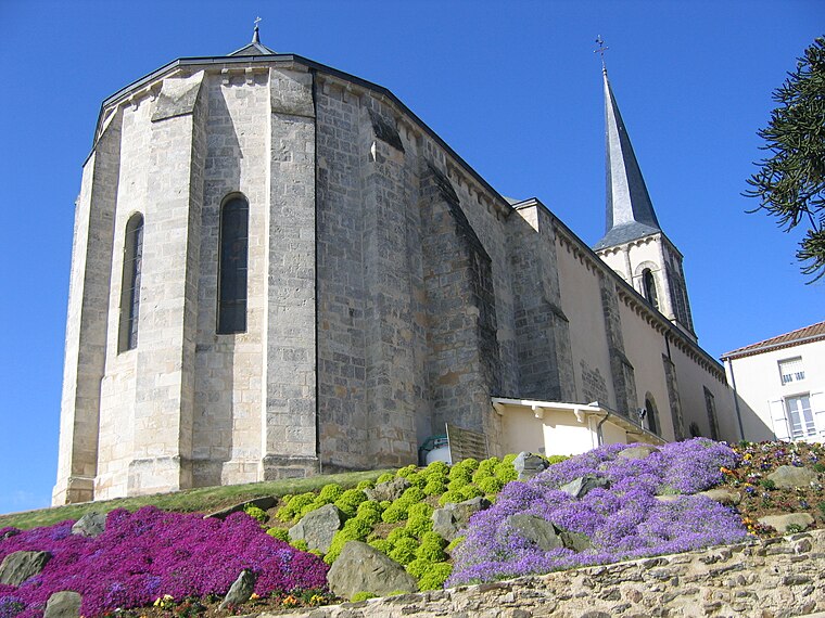
Photo: Mairiestpardoux79, CC BY-SA 4.0.
Église Saint-Pardoux de Saint-Pardoux is a church, which is situated 3 km north of Château d’eau de Mazières en Gatine.
Église Saint-Martin de Soutiers
Church

Photo: Domirance, CC BY-SA 4.0.
Église Saint-Martin de Soutiers is a church, which is situated 3½ km northeast of Château d’eau de Mazières en Gatine.
Places in the Area
Nearby places include Verruyes and La Boissière-en-Gâtine.
Verruyes
Village

Photo: Regissierra, Public domain.
Verruyes is a commune in the Deux-Sèvres department in western France. Verruyes is situated 3 km southeast of Château d’eau de Mazières en Gatine.
La Boissière-en-Gâtine
Village
La Boissière-en-Gâtine is a commune in the Deux-Sèvres department in the Nouvelle-Aquitaine region in western France. La Boissière-en-Gâtine is situated 5 km west of Château d’eau de Mazières en Gatine.
Allonne
Village

Photo: Allard-E, CC BY-SA 4.0.
Allonne is a commune in the Deux-Sèvres department in the Nouvelle-Aquitaine region in western France. It is situated some 5 km southeast of Secondigny and 14 km southwest of the town of Parthenay. Allonne is situated 7 km northwest of Château d’eau de Mazières en Gatine.
Château d’eau de Mazières en Gatine
- Type: Water tower
- Categories: building and industry
- Location: Deux-Sèvres, Nouvelle-Aquitaine, France, Europe
- View on OpenStreetMap
Latitude
46.54338° or 46° 32′ 36″ northLongitude
-0.30505° or 0° 18′ 18″ westHeight
37 metres (120 feet)Operator
SMEGOpen location code
8CRXGMVV+9XOpenStreetMap ID
way 64524753OpenStreetMap feature
building=yesOpenStreetMap feature
man_made=water_tower
This page is based on OpenStreetMap, Wikidata, and Wikimedia Commons.
We’d love your help improving our open data sources. Thank you for contributing.
Satellite Map
Discover Château d’eau de Mazières en Gatine from above in high-definition satellite imagery.
Notable Places Nearby
Highlights include Mémorial des Deux-Sèvres and Gendarmerie nationale.
Nearby Places
Explore places such as Pressigny and Lina-Tendu.
Curious Water Towers to Discover
Uncover intriguing water towers from every corner of the globe.
About Mapcarta. Data © OpenStreetMap contributors and available under the Open Database License". Text is available under the CC BY-SA 4.0 license, except for photos, directions, and the map. Photo: Père Igor, CC BY-SA 3.0.