Escuela Primaria Nº 50
Escuela Primaria Nº 50 is a school in Almirante Brown Partido, Buenos Aires which is located on Italia. Escuela Primaria Nº 50 is situated nearby to the sports venue Canarios Fútbol 5, as well as near the park Plaza Néstor Kirchner.| Tap on a place to explore it |
Places of Interest Nearby
Highlights include Burzaco Station and Emilio Burgwardt Hospital.
Burzaco Station
Railway station

Photo: Gustavo Durante, CC BY-SA 4.0.
Burzaco Station is a railway station, which is situated 1½ km west of Escuela Primaria Nº 50.
Emilio Burgwardt Hospital
Hospital
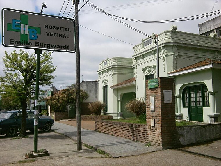
Photo: Wikimedia, CC BY-SA 3.0.
The Emilio Burgwardt Hospital is a hospital located in Longchamps, in the southern area of the Greater Buenos Aires. It is administered and owned by a civic society, Sociedad de Fomento Emilio Burgwardt. Emilio Burgwardt Hospital is situated 3½ km south of Escuela Primaria Nº 50.
Rafael Calzada train station
Railway station
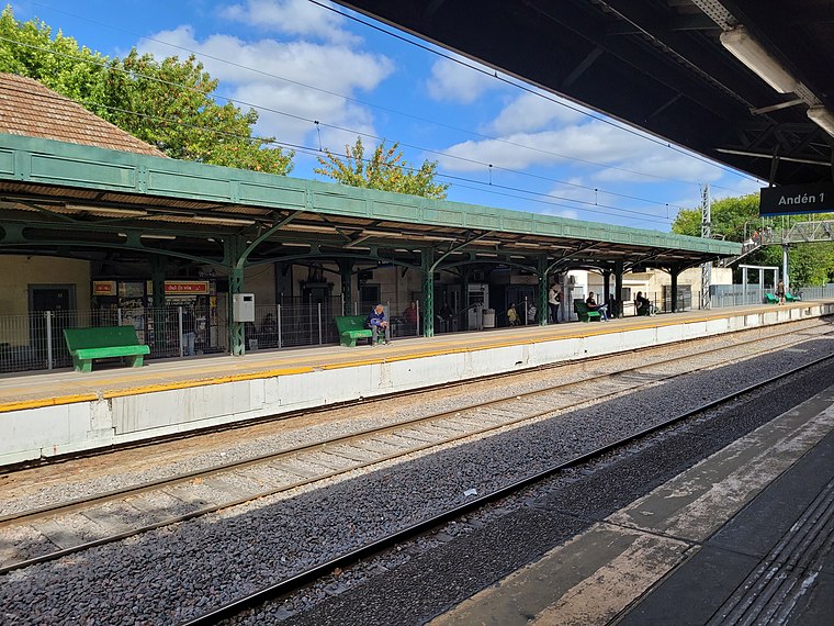
Photo: Hurfer, CC BY-SA 4.0.
Rafael Calzada train station is a railway station, which is situated 3½ km north of Escuela Primaria Nº 50.
Places in the Area
Nearby places include Burzaco and Adrogué.
Burzaco
Town

Photo: Ulises Icardi, CC BY-SA 4.0.
Burzaco is a city in Almirante Brown Partido, Buenos Aires Province, Argentina. It has an area of 22.77 km2, holds a population of 98,859. It is 27 kilometres from Buenos Aires city, to which it is linked by the Ferrocarril General Roca South.
Adrogué

Photo: Hurfer, CC BY-SA 4.0.
Adrogué is a city in Greater Buenos Aires, Argentina, located 23 km south of Buenos Aires. It is the administrative headquarters for Almirante Brown Partido.
Claypole
Town

Photo: Alpertron, CC BY-SA 3.0.
Claypole is an Argentine city located in the southern part of the Almirante Brown Partido, Buenos Aires Province with a population of 41,176. Claypole is situated 3½ km northeast of Escuela Primaria Nº 50.
Escuela Primaria Nº 50
- Type: School
- Address: 1759 Italia
- Category: education
- Location: Almirante Brown Partido, Buenos Aires, Pampas, Argentina, South America
- View on OpenStreetMap
Latitude
-34.82592° or 34° 49′ 33″ southLongitude
-58.37311° or 58° 22′ 23″ westOpen location code
48Q35JFG+JQOpenStreetMap ID
way 648928799OpenStreetMap feature
amenity=school
This page is based on OpenStreetMap, Wikidata, and Wikimedia Commons.
We’d love your help improving our open data sources. Thank you for contributing.
Satellite Map
Discover Escuela Primaria Nº 50 from above in high-definition satellite imagery.
Notable Places Nearby
Highlights include Canarios Fútbol 5 and Plaza Néstor Kirchner.
Nearby Places
Explore places such as Pago Fácil and Guggiari.
Buenos Aires: Must-Visit Destinations
Delve into Buenos Aires, La Plata, Mar del Plata, and Centro.
Curious Schools to Discover
Uncover intriguing schools from every corner of the globe.
About Mapcarta. Data © OpenStreetMap contributors and available under the Open Database License". Text is available under the CC BY-SA 4.0 license, except for photos, directions, and the map. Photo: Mbusin, CC BY-SA 4.0.