Frutas y Verduras Derecho
Frutas y Verduras Derecho is an industrial building in Plasencia, Caceres, Extremadura. Frutas y Verduras Derecho is situated nearby to the park Parque de Guadalupe, as well as near Plaza de la Carretera de Malpartida.| Tap on a place to explore it |
Places of Interest Nearby
Highlights include Plasencia railway station and Palacio de Monroy.
Plasencia railway station
Railway station
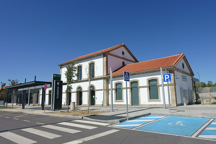
Photo: Rodelar, CC BY-SA 4.0.
The Plasencia railway station is a railway station serving the Spanish city of Plasencia, in the province of Cáceres. It was inaugurated on 26 July 1893, with the opening of the 55 km stretch between Plasencia and Hervás of the wider Plasencia–Astorga line. Plasencia railway station is situated 1 km north of Frutas y Verduras Derecho.
Palacio de Monroy

Photo: Jesusccastillo, CC BY-SA 3.0 es.
Palacio de Monroy is situated 2 km north of Frutas y Verduras Derecho.
Puerta de Trujillo
City gate
 Puerta de Trujillo is a city gate, which is situated 2 km northeast of Frutas y Verduras Derecho.
Places in the Area
Nearby places include Malpartida de Plasencia.
Malpartida de Plasencia
Village

Photo: Jose Antonio Cotallo López, CC BY 2.0.
Malpartida de Plasencia is a municipality located in the province of Cáceres, Extremadura, Spain. According to the 2015 census, the municipality has a population of 4714 inhabitants. Malpartida de Plasencia is situated 6 km southeast of Frutas y Verduras Derecho.
Frutas y Verduras Derecho
- Type: Industrial building
- Categories: building and industry
- Location: Plasencia, Caceres, Extremadura, Central Spain, Spain, Iberia, Europe
- View on OpenStreetMap
Latitude
40.01234° or 40° 0′ 44″ northLongitude
-6.10108° or 6° 6′ 4″ westOpen location code
8CGM2V6X+WHOpenStreetMap ID
way 650154335OpenStreetMap feature
building=industrial
This page is based on OpenStreetMap, Wikidata, and Wikimedia Commons.
We’d love your help improving our open data sources. Thank you for contributing.
Satellite Map
Discover Frutas y Verduras Derecho from above in high-definition satellite imagery.
Notable Places Nearby
Highlights include Parque de Guadalupe and Plaza de la Carretera de Malpartida.
Nearby Places
Explore places such as JARDINTEC Jardinería Técnica Norte Extremeña and PESCANOEX Lonjas de Pescado.
Extremadura: Must-Visit Destinations
Delve into Mérida, Badajoz, Caceres, and Trujillo.
Curious Industrial Buildings to Discover
Uncover intriguing industrial buildings from every corner of the globe.
About Mapcarta. Data © OpenStreetMap contributors and available under the Open Database License". Text is available under the CC BY-SA 4.0 license, except for photos, directions, and the map. Photo: Anual, CC BY-SA 4.0.