Centro de Día Municipal Juan Pablo II
Centro de Día Municipal Juan Pablo II is a social service facility in Chamartín, Madrid, Community of Madrid. Centro de Día Municipal Juan Pablo II is situated nearby to the shopping center Alcampo Pío XII, as well as near the garden Jardines de Gloria Fuertes.| Tap on a place to explore it |
Places of Interest Nearby
Highlights include Pío XII and Embassy of Equatorial Guinea.
Pío XII
Metro station
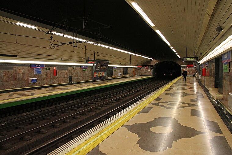
Photo: Draceane, CC BY-SA 4.0.
Pío XII is a station on Line 9 of the Madrid Metro, located under the Avenida de Pío XII. It is in fare Zone A. Pío XII is situated 220 metres southwest of Centro de Día Municipal Juan Pablo II.
Embassy of Equatorial Guinea
Government office
 Embassy of Equatorial Guinea is a government office, which is situated 240 metres north of Centro de Día Municipal Juan Pablo II.
Apostolic Nunciature
Government office

Photo: Krokodyl, CC BY-SA 3.0.
The Apostolic Nunciature to the Kingdom of Spain is an ecclesiastical office of the Catholic Church in Spain. It is a diplomatic post of the Holy See, whose representative is called the Apostolic Nuncio with the rank of an ambassador. Apostolic Nunciature is situated 620 metres north of Centro de Día Municipal Juan Pablo II.
Places in the Area
Nearby places include Nueva España and Chamartin.
Nueva España
Quarter
 Nueva España is an administrative neighborhood of Madrid, belonging to the district of Chamartín. The ward is notable for its strong public transportation, the concentration and quality of its schools and its high level of income.
Chamartin
Suburb

Photo: emedeme, CC BY-SA 2.0.
Chamartín is an administrative district of Madrid, Spain and consists of the following neighbourhoods: El Viso, La Prosperidad, Ciudad Jardín, Hispanoamérica, Nueva España, and Castilla.
Hispanoamérica
Quarter

Photo: Alejandro Polanco, CC BY 3.0.
Hispanoamérica is an administrative neighborhood of Madrid belonging to the district of Chamartín. It has an area of 1.707406 km2. As of 1 March 2020, it has a population of 32,181.
Centro de Día Municipal Juan Pablo II
- Type: Social service facility
- Category: building
- Location: Chamartín, Madrid, Madrid, Community of Madrid, Central Spain, Spain, Iberia, Europe
- View on OpenStreetMap
Latitude
40.46281° or 40° 27′ 46″ northLongitude
-3.67424° or 3° 40′ 27″ westOpen location code
8CGRF87G+48OpenStreetMap ID
way 650758601OpenStreetMap feature
amenity=social_facilityOpenStreetMap feature
building=yes
This page is based on OpenStreetMap, Wikidata, and Wikimedia Commons.
We’d love your help improving our open data sources. Thank you for contributing.
Satellite Map
Discover Centro de Día Municipal Juan Pablo II from above in high-definition satellite imagery.
Notable Places Nearby
Highlights include Alcampo Pío XII and Jardines de Gloria Fuertes.
Nearby Places
Explore places such as Alcampo and Pío XII.
Madrid: Must-Visit Destinations
Delve into Sol-Letras-Lavapiés, Salamanca, Retiro-Paseo del Arte, and Chamberí-Castellana.
Curious Social Service Facilities to Discover
Uncover intriguing social service facilities from every corner of the globe.
About Mapcarta. Data © OpenStreetMap contributors and available under the Open Database License". Text is available under the CC BY-SA 4.0 license, except for photos, directions, and the map. Photo: DonPaolo, CC BY-SA 3.0.