Central Hidroeléctrica de Palomarejos
Central Hidroeléctrica de Palomarejos is a power station in Talavera de la Reina, Toledo, Castile-La Mancha. Central Hidroeléctrica de Palomarejos is situated nearby to Castilla–La Mancha Bridge, as well as near the town Talavera de la Reina.| Tap on a place to explore it |
Places of Interest Nearby
Highlights include Castilla–La Mancha Bridge and Hospital General Universitario Nuestra Señora del Prado.
Castilla–La Mancha Bridge
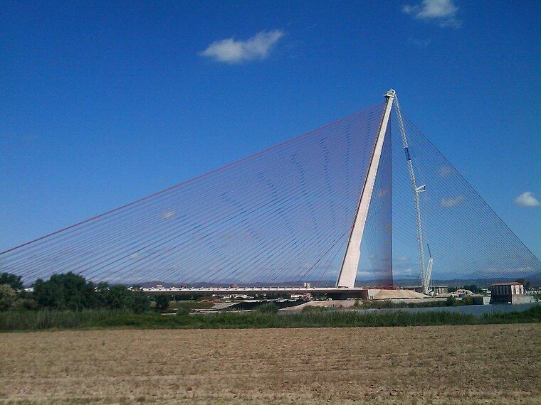
Photo: Nyeke, CC BY-SA 4.0.
The Castilla–La Mancha Bridge is a cable-stayed bridge in Talavera de la Reina, Spain. Castilla–La Mancha Bridge is situated 390 metres southwest of Central Hidroeléctrica de Palomarejos.
Hospital General Universitario Nuestra Señora del Prado
Hospital

Photo: Asqueladd, CC BY-SA 3.0.
Hospital General Universitario Nuestra Señora del Prado is situated 1½ km north of Central Hidroeléctrica de Palomarejos.
Basilica of Nuestra Señora del Prado
Church

Photo: Javiergil73, CC BY-SA 3.0.
The Basilica of Nuestra Señora del Prado is a Roman Catholic basilica in Talavera de la Reina, Spain. Basilica of Nuestra Señora del Prado is situated 2 km northwest of Central Hidroeléctrica de Palomarejos.
Places in the Area
Nearby places include Talavera de la Reina and Talavera la Nueva.
Talavera de la Reina
Town

Photo: Victormdm98, CC BY-SA 3.0.
Talavera de la Reina is a town, which is situated 2½ km west of Central Hidroeléctrica de Palomarejos.
Talavera la Nueva
Village
 Talavera la Nueva is an EATIM belonging to the municipality of Talavera de la Reina, Spain. Talavera la Nueva is situated 8 km west of Central Hidroeléctrica de Palomarejos.
Pepino
Village

Photo: Asqueladd, CC BY-SA 3.0.
Pepino is a municipality in the province of Toledo, Castile-La Mancha, in central Spain. According to the 2017 census the municipality has a population of 2,809 inhabitants. Pepino is situated 9 km north of Central Hidroeléctrica de Palomarejos.
Central Hidroeléctrica de Palomarejos
- Type: Power station
- Address: Talavera de la Reina, 45600
- Category: industry
- Location: Talavera de la Reina, Toledo, Castile-La Mancha, Central Spain, Spain, Iberia, Europe
- View on OpenStreetMap
Latitude
39.95208° or 39° 57′ 8″ northLongitude
-4.80344° or 4° 48′ 12″ westOperator
IberdrolaOpen location code
8CFQX52W+RJOpenStreetMap ID
way 660476631
This page is based on OpenStreetMap, Wikidata, and Wikimedia Commons.
We’d love your help improving our open data sources. Thank you for contributing.
Satellite Map
Discover Central Hidroeléctrica de Palomarejos from above in high-definition satellite imagery.
Notable Places Nearby
Highlights include Área de autocaravanas de Talavera and Bomberos de Talavera de la Reina.
Nearby Places
Explore places such as Reymat and Biona.
Castile-La Mancha: Must-Visit Destinations
Delve into Toledo, Albacete, Cuenca, and Ciudad Real.
Curious Power Stations to Discover
Uncover intriguing power stations from every corner of the globe.
About Mapcarta. Data © OpenStreetMap contributors and available under the Open Database License". Text is available under the CC BY-SA 4.0 license, except for photos, directions, and the map. Photo: Diliff, CC BY-SA 3.0.