Ziaja Rzeszów
Ziaja Rzeszów is in Rzeszów, Podkarpackie. Ziaja Rzeszów is situated nearby to the historic building Dom woźnego, as well as near spichlerz.| Tap on a place to explore it |
Places of Interest Nearby
Highlights include Saint Hubertus chapel in Rzeszów and Rzeszów Dworzysko.
Saint Hubertus chapel in Rzeszów
Church

Photo: Wikimedia, CC BY-SA 4.0.
Saint Hubertus chapel in Rzeszów is a church, which is situated 1¼ km east of Ziaja Rzeszów.
Rzeszów Dworzysko
Railway stop

Photo: Patryk2710, CC BY 4.0.
Rzeszów Dworzysko is a railway stop, which is situated 1 km north of Ziaja Rzeszów.
Miłocin
Railway stop
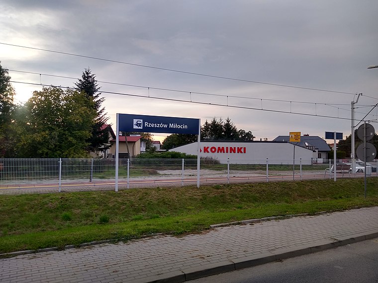
Photo: Patryk2710, CC BY-SA 4.0.
Miłocin is a railway stop, which is situated 1½ km northeast of Ziaja Rzeszów.
Places in the Area
Nearby places include Rudna Wielka and Zaczernie.
Rudna Wielka
Village

Photo: Wikimedia, CC BY-SA 3.0.
Rudna Wielka is a village in the administrative district of Gmina Świlcza, within Rzeszów County, Subcarpathian Voivodeship, in south-eastern Poland. It lies approximately 4 km north-east of Świlcza and 7 km north-west of the regional capital Rzeszów. Rudna Wielka is situated 2½ km northwest of Ziaja Rzeszów.
Zaczernie
Village

Photo: Patryk2710, CC BY 4.0.
Zaczernie is a village in the administrative district of Gmina Trzebownisko, within Rzeszów County, Subcarpathian Voivodeship, in south-eastern Poland. It lies approximately 4 km north-west of Trzebownisko and 8 km north of the regional capital Rzeszów. Zaczernie is situated 3 km northeast of Ziaja Rzeszów.
Rudna Mała
Village

Photo: Patryk2710, CC BY-SA 4.0.
Rudna Mała is a village in the administrative district of Gmina Głogów Małopolski, within Rzeszów County, Subcarpathian Voivodeship, in south-eastern Poland. Rudna Mała is situated 3 km north of Ziaja Rzeszów.
Ziaja Rzeszów
- Type: Industry
- Location: Rzeszów, Podkarpackie, Poland, Central Europe, Europe
- View on OpenStreetMap
Latitude
50.07043° or 50° 4′ 14″ northLongitude
21.96895° or 21° 58′ 8″ eastOpen location code
9G233XC9+5HOpenStreetMap ID
way 663955089OpenStreetMap feature
landuse=industrial
This page is based on OpenStreetMap, Wikidata, and Wikimedia Commons.
We’d love your help improving our open data sources. Thank you for contributing.
Satellite Map
Discover Ziaja Rzeszów from above in high-definition satellite imagery.
Notable Places Nearby
Highlights include Dom woźnego and spichlerz.
Nearby Places
Explore places such as Netrix and Linea.
Podkarpackie: Must-Visit Destinations
Delve into Tarnobrzeg, Przemyśl, Sanok, and Krosno.
Curious Places to Discover
Uncover intriguing places from every corner of the globe.
About Mapcarta. Data © OpenStreetMap contributors and available under the Open Database License". Text is available under the CC BY-SA 4.0 license, except for photos, directions, and the map. Photo: Szczepek, CC BY-SA 3.0.