SENIAT
SENIAT is an office building in Municipio Pedro María Ureña, Táchira which is located on Paso Fronterizo de Tienditas. SENIAT is situated nearby to the border checkpoint Control Fronterizo de Tienditas, as well as near Tienditas Bridge.| Tap on a place to explore it |
- Type: Office building
- Address: Paso Fronterizo de Tienditas, Tienditas, TA 5048
- Wheelchair access: yes
Places of Interest Nearby
Highlights include Tienditas Bridge.
Tienditas Bridge
Bridge

Photo: EEIM, CC BY-SA 4.0.
Tienditas International Bridge is a vehicular and pedestrian bridge connecting Táchira, Venezuela with Norte de Santander, Colombia. Tienditas Bridge is situated 620 metres southwest of SENIAT.
Places in the Area
Nearby places include San Luis, Cúcuta and Los Caobos, Cúcuta.
San Luis, Cúcuta
Neighborhood

Photo: EEIM, CC BY-SA 3.0.
San Luis, Cúcuta is a neighborhood, which is situated 4 km northwest of SENIAT.
Los Caobos, Cúcuta
Neighborhood

Photo: EEIM, CC BY-SA 3.0.
Los Caobos, Cúcuta is a neighborhood, which is situated 5 km west of SENIAT.
Villa del Rosario
Town
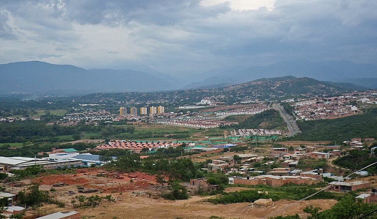
Photo: EEIM, CC BY-SA 3.0.
Villa del Rosario is a Colombian municipality and city located in the eastern part of North Santander department. It is part of the Metropolitan Area of Cúcuta. Villa del Rosario is situated 6 km southwest of SENIAT.
SENIAT
- Categories: government office, building, and office
- Location: Municipio Pedro María Ureña, Táchira, Andes, Venezuela, South America
- View on OpenStreetMap
Latitude
7.87917° or 7° 52′ 45″ northLongitude
-72.44784° or 72° 26′ 52″ westLevels
1Open location code
67V9VHH2+MVOpenStreetMap ID
way 668288379OpenStreetMap feature
building=officeOpenStreetMap feature
office=governmentOpenStreetMap attribute
wheelchair=yes
This page is based on OpenStreetMap, Wikidata, and Wikimedia Commons.
We’d love your help improving our open data sources. Thank you for contributing.
Satellite Map
Discover SENIAT from above in high-definition satellite imagery.
Places with the Same Name
Discover other places named “SENIAT”.
Notable Places Nearby
Highlights include Control Fronterizo de Tienditas and SUB-ESTACION POLICIAL TIENDITAS.
Nearby Places
Explore places such as Edificio Centro Nacional de Fronteras CENAF and Estacionamiento A, Paso Fronterizo.
Andes: Must-Visit Destinations
Delve into Mérida, Trujillo, San Cristóbal, and Santo Domingo.
Curious Office Buildings to Discover
Uncover intriguing office buildings from every corner of the globe.
About Mapcarta. Data © OpenStreetMap contributors and available under the Open Database License". Text is available under the CC BY-SA 4.0 license, except for photos, directions, and the map. Photo: Wikimedia, CC0.