Guardia Civil
Guardia Civil is a police station in Burgos, Castile and León. Guardia Civil is situated nearby to the post office Correos Express, as well as near the public building CEEI Burgos.| Tap on a place to explore it |
Places of Interest Nearby
Highlights include Burgos Villafria Airport and Estación de Burgos-Villafría.
Burgos Villafria Airport
Aerodrome
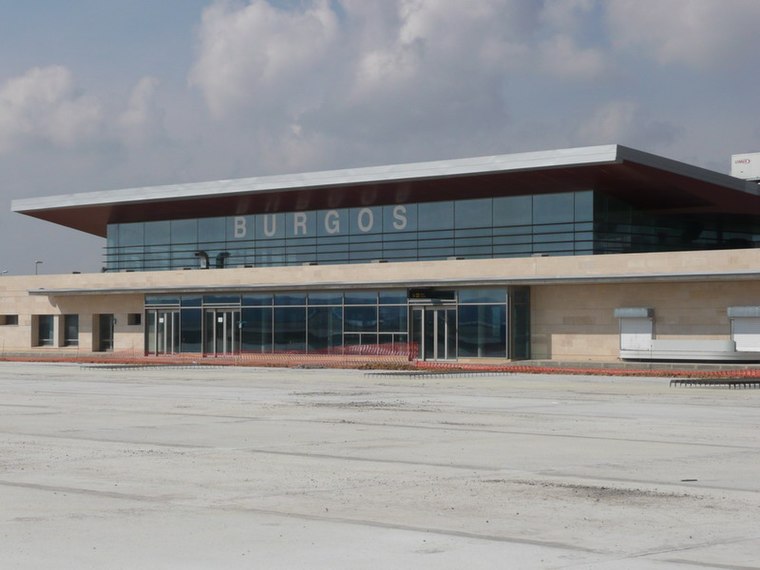
Photo: Forjamus, Public domain.
Burgos Airport, also known as Villafría, is an airport located 4 kilometres east of the historic center of Burgos, a city in Spain. The company Aeronova has its maintenance headquarters in Villafría.
Estación de Burgos-Villafría
House

Photo: DaddyCell, CC BY-SA 4.0.
Estación de Burgos-Villafría is a house, which is situated 610 metres east of Guardia Civil.
Burgos-Rosa Manzano railway station
Railway station

Photo: Jardoz, CC BY-SA 3.0.
Burgos-Rosa Manzano railway station, previously known as Burgos Rosa de Lima railway station, serves the Spanish city of Burgos, Castile and León. The station opened in 2008, named after the politician Rosa de Lima Manzano Gete responsible for the Directorate-General for Traffic and killed in service in 1988 in a helicopter accident. Burgos-Rosa Manzano railway station is situated 3½ km west of Guardia Civil.
Places in the Area
Nearby places include Villafría and Villímar.

Villayuda
Suburb

Photo: Taurëendil, CC BY-SA 4.0.
Villayuda is a suburb, which is situated 2½ km southwest of Guardia Civil.
Guardia Civil
- Type: Police station
- Category: building
- Location: Burgos, Burgos, Castile and León, Central Spain, Spain, Iberia, Europe
- View on OpenStreetMap
Latitude
42.36044° or 42° 21′ 38″ northLongitude
-3.62923° or 3° 37′ 45″ westOpen location code
8CJR996C+58OpenStreetMap ID
way 668549324OpenStreetMap feature
amenity=policeOpenStreetMap feature
building=yes
This page is based on OpenStreetMap, Wikidata, and Wikimedia Commons.
We’d love your help improving our open data sources. Thank you for contributing.
Satellite Map
Discover Guardia Civil from above in high-definition satellite imagery.
Places with the Same Name
Discover other places named “Guardia Civil”.
Notable Places Nearby
Highlights include Correos Express and CEEI Burgos.
Nearby Places
Explore places such as Puesto Guardia Civil and Frioes XXI.
Castile and León: Must-Visit Destinations
Delve into Valladolid, Salamanca, León, and Segovia.
Curious Police Stations to Discover
Uncover intriguing police stations from every corner of the globe.
About Mapcarta. Data © OpenStreetMap contributors and available under the Open Database License". Text is available under the CC BY-SA 4.0 license, except for photos, directions, and the map. Photo: Choniron, CC BY-SA 3.0 es.