Wormser Einkaufspark
Wormser Einkaufspark is a commercial area in Worms, Rhenish Hesse, Rhineland-Palatinate which is located on Schönauer Straße. Wormser Einkaufspark is situated nearby to the health club Venice Beach, as well as near McFit.| Tap on a place to explore it |
- Type: Commercial area
- Also known as: “WEP”
- Address: Schönauer Straße 8, Worms, 67547
Places of Interest Nearby
Highlights include Old Jewish cemetery “Holy Sand” and Worms Cathedral.
Old Jewish cemetery “Holy Sand”
Protected area
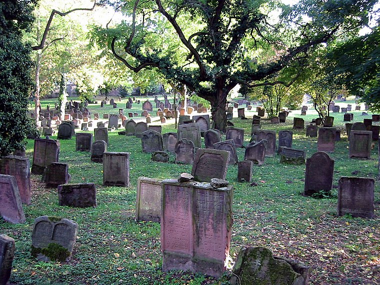
Photo: PanchoS, Public domain.
The Jewish Cemetery in Worms or Heiliger Sand, in Worms, Germany, is usually called the oldest surviving Jewish cemetery in Europe, although the Jewish burials in the Jewish sections of the Roman catacombs predate it by a millennium. Old Jewish cemetery “Holy Sand” is situated 580 metres northwest of Wormser Einkaufspark.
Worms Cathedral
Church
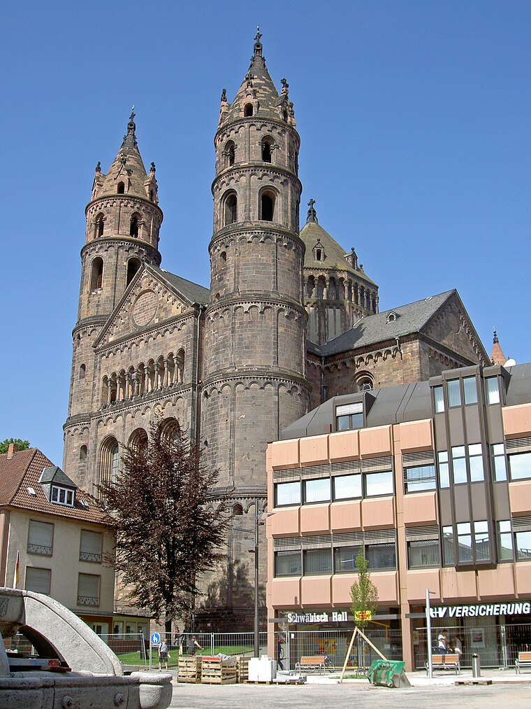
Photo: Wikimedia, CC BY-SA 3.0.
St Peter's Cathedral is a Roman Catholic church and former cathedral in Worms, southern Germany. The cathedral is located on the highest point of the inner city of Worms and is the most important building of the Romanesque style in Worms. Worms Cathedral is situated 560 metres north of Wormser Einkaufspark.
Magnuskirche
Church

Photo: Chris06, Public domain.
The Magnuskirche is a small church in Worms, Germany, to the south of Worms Cathedral. It is the city's smallest church. Archaeological evidence and its dedication suggest it originated in the 8th century - part of that building survives in the nave's north wall. Magnuskirche is situated 430 metres north of Wormser Einkaufspark.
Places in the Area
Nearby places include Trinity Church, Worms and Hochheim.
Trinity Church, Worms
Locality

Photo: Immanuel Giel, Public domain.
The Holy Trinity Church, full name Reformation Memorial Church of the Holy Trinity is the largest Protestant church in Worms. The baroque hall building is centrally located on the market square of the city and is now under conservation.
Hochheim
Suburb

Photo: Lirion, CC BY-SA 3.0.
Hochheim is a suburb, which is situated 2½ km northwest of Wormser Einkaufspark.
Horchheim
Suburb

Photo: PMScigne, Public domain.
Horchheim is a suburb, which is situated 3 km southwest of Wormser Einkaufspark.
Wormser Einkaufspark
Latitude
49.62506° or 49° 37′ 30″ northLongitude
8.36059° or 8° 21′ 38″ eastOpen location code
8FXCJ9G6+26OpenStreetMap ID
way 683489016OpenStreetMap feature
landuse=retail
This page is based on OpenStreetMap, Wikidata, and Wikimedia Commons.
We’d love your help improving our open data sources. Thank you for contributing.
Satellite Map
Discover Wormser Einkaufspark from above in high-definition satellite imagery.
Notable Places Nearby
Highlights include Venice Beach and Landesbetrieb Mobilität Rheinland-Pfalz.
Nearby Places
Explore places such as Aldi Süd and KiK.
Rhenish Hesse: Must-Visit Destinations
Delve into Mainz, Bingen, Ingelheim, and Oppenheim.
Curious Commercial Areas to Discover
Uncover intriguing commercial areas from every corner of the globe.
About Mapcarta. Data © OpenStreetMap contributors and available under the Open Database License". Text is available under the CC BY-SA 4.0 license, except for photos, directions, and the map. Photo: Pratz53, CC BY-SA 4.0.