First Hole Tee Box
First Hole Tee Box is a grassland in Alameda, California. First Hole Tee Box is situated nearby to Lake Chabot Golf Course, as well as near the pitch First Hole Putting Green.| Tap on a place to explore it |
Places of Interest Nearby
Highlights include Oakland Zoo and Dunsmuir House.
Oakland Zoo
Zoo
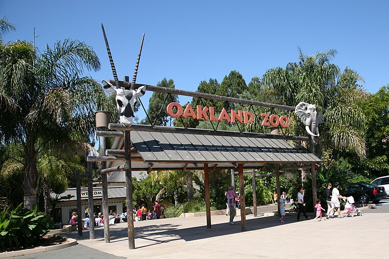
Photo: Wikimedia, CC BY-SA 2.0.
The Oakland Zoo is located in the Grass Valley neighborhood of Oakland, California, United States. Established on June 6, 1922, it is managed by the Conservation Society of California, a 501 non-profit organization dedicated to the conservation of wildlife both locally and globally. Oakland Zoo is situated 1½ miles northwest of First Hole Tee Box.
Dunsmuir House
Museum
The Dunsmuir House and Gardens is located in Oakland, California on a 50-acre site. The Dunsmuir House has a neoclassical-revival architectural style and is listed in the U.S. National Register of Historic Places. Dunsmuir House is situated 1¼ miles west of First Hole Tee Box.
Chabot 31-005 Dam
Dam

Photo: Semiautonomous, CC BY-SA 4.0.
Chabot 31-005 Dam is situated 4,000 feet south of First Hole Tee Box.
Places in the Area
Nearby places include San Leandro and Elmhurst.
San Leandro

Photo: Wsiegmund, CC BY-SA 3.0.
San Leandro is a mid-size city of about 90,000 people in the San Francisco Bay Area in Northern California in the United States of America.
Elmhurst
Neighborhood
Elmhurst is a residential neighborhood in the southernmost part of Oakland, California. Originally a separate unincorporated town, it was annexed by Oakland in 1909, and today is considered part of East Oakland. It lies at an elevation of 39 feet. Elmhurst is situated 3 miles west of First Hole Tee Box.
Ashland
Village

Photo: Naddruf, CC BY-SA 4.0.
Ashland is a census-designated place and unincorporated community in Alameda County, California, United States. The population was 23,823 at the 2020 census. Ashland is situated 3 miles south of First Hole Tee Box.
First Hole Tee Box
- Type: Grassland
- Location: Alameda, California, United States, North America
- View on OpenStreetMap
Latitude
37.73979° or 37° 44′ 23″ northLongitude
-122.11917° or 122° 7′ 9″ westOpen location code
849VPVQJ+W8OpenStreetMap ID
way 685036799OpenStreetMap feature
landuse=grass
This page is based on OpenStreetMap, Wikidata, and Wikimedia Commons.
We’d love your help improving our open data sources. Thank you for contributing.
Satellite Map
Discover First Hole Tee Box from above in high-definition satellite imagery.
Notable Places Nearby
Highlights include Lake Chabot Golf Course and First Hole Putting Green.
Nearby Places
Explore places such as Pro Shop and Hawk Ridge Group Camping Area.
California: Must-Visit Destinations
Delve into San Francisco, Los Angeles, San Diego, and Sacramento.
Curious Grasslands to Discover
Uncover intriguing grasslands from every corner of the globe.
About Mapcarta. Data © OpenStreetMap contributors and available under the Open Database License". Text is available under the CC BY-SA 4.0 license, except for photos, directions, and the map. Photo: Miskatonic, CC BY 2.5.