Mont Pipau
Mont Pipau is a forest in Saint-Michel-sur-Orge, Arrondissement of Palaiseau, Île-de-France. Mont Pipau is situated nearby to the town Sainte-Geneviève-des-Bois, as well as near the neighborhood La Mare des Bordes.| Tap on a place to explore it |
Places of Interest
Highlights include Sainte-Geneviève-des-Bois Russian Cemetery and Sainte-Geneviève-des-Bois station.
Sainte-Geneviève-des-Bois Russian Cemetery
Cemetery

Photo: Wikimedia, Public domain.
Sainte-Geneviève-des-Bois Russian Cemetery is part of the Cimetière de Liers and is called the Russian Orthodox cemetery, in Sainte-Geneviève-des-Bois, close to Paris, France.
Sainte-Geneviève-des-Bois station
Railway station
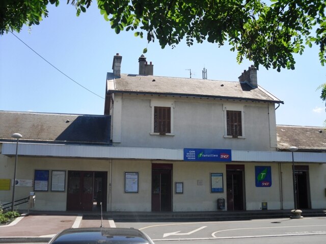
Photo: Cyrilb1881, CC BY-SA 3.0.
Sainte-Geneviève-des-Bois is a railway station in Sainte-Geneviève-des-Bois, Essonne, Paris, France. The station was opened in 1881 and is on the Paris–Bordeaux railway.
Saint-Michel-sur-Orge station
Railway station

Photo: Ségala, CC BY-SA 3.0.
Saint-Michel-sur-Orge is a railway station in Saint-Michel-sur-Orge, Essonne, Paris, France. The station was opened in 1843 and is on the Paris–Bordeaux railway.
Places in the Area
Nearby places include Sainte-Geneviève-des-Bois and Brétigny-sur-Orge.
Sainte-Geneviève-des-Bois
Town

Photo: Jcognard, Public domain.
Sainte-Geneviève-des-Bois is a commune in the southern suburbs of Paris, France. It is located 23.5 km from the center of Paris, in the arrondissement of Palaiseau, Essonne department, Île-de-France.
Brétigny-sur-Orge
Town
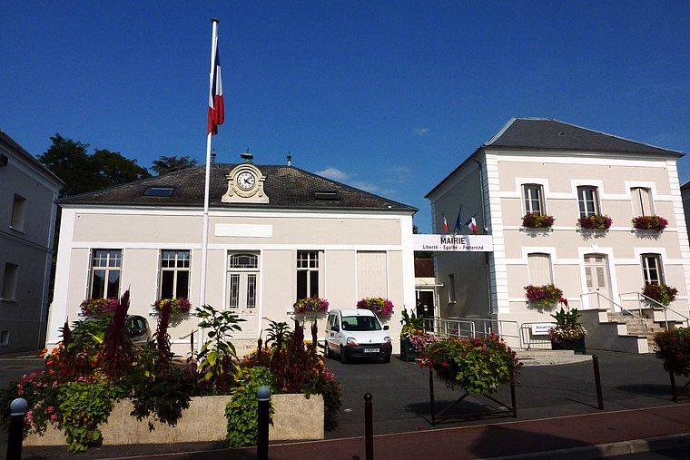
Photo: Erdrokan, CC BY-SA 3.0.
Brétigny-sur-Orge is a commune in the southern suburbs of Paris, France, 26.7 km from the city center.
Saint-Michel-sur-Orge
Town

Photo: Véronique PAGNIER, Public domain.
Saint-Michel-sur-Orge is a commune in the Essonne département of France. It is in the southern suburbs of Paris, 24.7 km from the center of Paris. Inhabitants of Saint-Michel-sur-Orge are known as Saint-Michellois.
Mont Pipau
- Type: Forest
- Location: Saint-Michel-sur-Orge, Arrondissement of Palaiseau, Essonne, Île-de-France, France, Europe
- View on OpenStreetMap
Latitude
48.6403° or 48° 38′ 25″ northLongitude
2.3131° or 2° 18′ 47″ eastOpen location code
8FW4J8R7+46OpenStreetMap ID
way 690493940OpenStreetMap feature
natural=wood
This page is based on OpenStreetMap, Wikidata, and Wikimedia Commons.
We’d love your help improving our open data sources. Thank you for contributing.
Satellite Map
Discover Mont Pipau from above in high-definition satellite imagery.
Localities in the Area
Explore places such as La Mare des Bordes and Résidence Bellevue.
Notable Places Nearby
Highlights include Mont Pipau and Place Yvonne et Jeannine Trihoreau.
Île-de-France: Must-Visit Destinations
Delve into Paris, Versailles, Boulogne-Billancourt, and Paris Charles de Gaulle Airport.
Curious Forests to Discover
Uncover intriguing forests from every corner of the globe.
About Mapcarta. Data © OpenStreetMap contributors and available under the Open Database License". Text is available under the CC BY-SA 4.0 license, except for photos, directions, and the map. Photo: Olybrius, CC BY-SA 3.0.