Freiwillige Feuerwehr Gonzerath
Freiwillige Feuerwehr Gonzerath is a fire station in Morbach, Bernkastel-Wittlich, Rhineland-Palatinate. Freiwillige Feuerwehr Gonzerath is situated nearby to the peak Schackberg, as well as near the reservoir Hochbehälter Gonzerath.| Tap on a place to explore it |
Places of Interest Nearby
Highlights include Belginum Archaeological Park and Burg Baldenau.
Belginum Archaeological Park
Museum
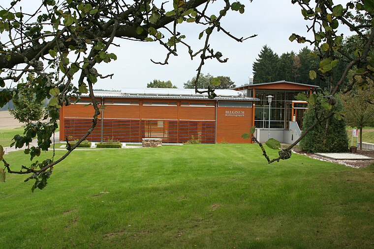
Photo: MSeses, CC BY-SA 3.0.
Belginum Archaeological Park is a museum, which is situated 3½ km east of Freiwillige Feuerwehr Gonzerath.
Burg Baldenau
Castle

Photo: Kolling, CC BY-SA 3.0.
Burg Baldenau is a castle, which is situated 4 km southeast of Freiwillige Feuerwehr Gonzerath.
Stumpfer Turm Morbach
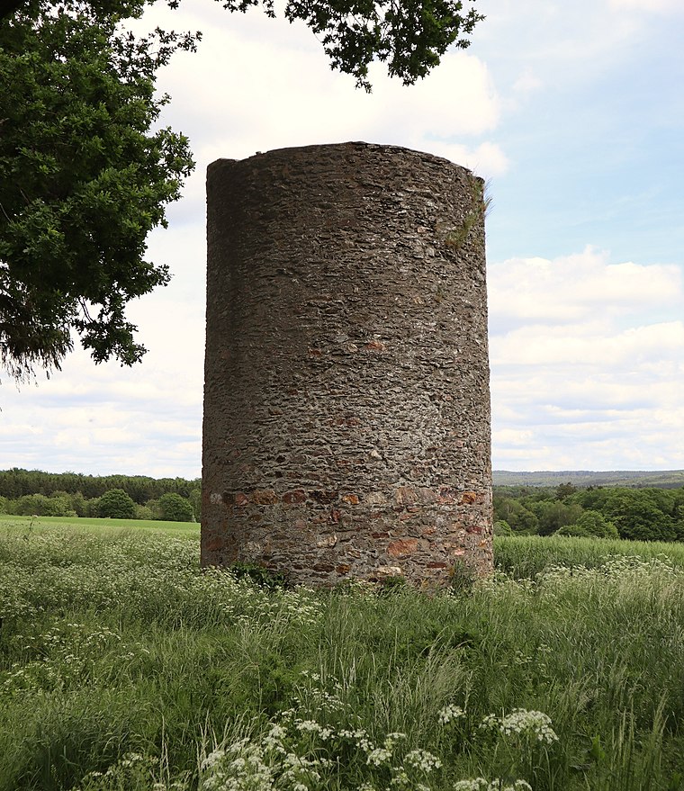
Photo: Palauenc05, CC BY-SA 4.0.
Stumpfer Turm Morbach is situated 3½ km east of Freiwillige Feuerwehr Gonzerath.
Places in the Area
Nearby places include Ilsbach and Rapperath.
Ilsbach
Hamlet

Photo: Wikimedia, Copyrighted free use.
Ilsbach is a hamlet, which is situated 4 km northeast of Freiwillige Feuerwehr Gonzerath.
Rapperath
Village

Photo: Kinan98, CC BY-SA 3.0.
Rapperath is a village, which is situated 4½ km south of Freiwillige Feuerwehr Gonzerath.
Morbach
Town

Photo: Timo Beil, CC BY-SA 3.0.
Morbach is a municipality that belongs to no Verbandsgemeinde – a kind of collective municipality – in the Bernkastel-Wittlich district in Rhineland-Palatinate, Germany. It is also a state-recognized climatic resort. Morbach is situated 5 km south of Freiwillige Feuerwehr Gonzerath.
Freiwillige Feuerwehr Gonzerath
- Type: Fire station
- Also known as: “Freiwillige Feuerwehr Morbach Löschgruppe Gonzerath”
- Categories: building and public building
- Location: Morbach, Bernkastel-Wittlich, Rhineland-Palatinate, Germany, Central Europe, Europe
- View on OpenStreetMap
Latitude
49.85474° or 49° 51′ 17″ northLongitude
7.11839° or 7° 7′ 6″ eastOperator
Gemeinde MorbachOpen location code
8FX9V439+V9OpenStreetMap ID
way 719468282OpenStreetMap feature
amenity=fire_stationOpenStreetMap feature
building=public
This page is based on OpenStreetMap, Wikidata, and Wikimedia Commons.
We’d love your help improving our open data sources. Thank you for contributing.
Satellite Map
Discover Freiwillige Feuerwehr Gonzerath from above in high-definition satellite imagery.
Notable Places Nearby
Highlights include Schackberg and Hochbehälter Gonzerath.
Nearby Places
Explore places such as SV Gonzerath and Gonzerath, Gemeindehaus.
Rhineland-Palatinate: Must-Visit Destinations
Delve into Mainz, Trier, Koblenz, and Worms.
Curious Fire Stations to Discover
Uncover intriguing fire stations from every corner of the globe.
About Mapcarta. Data © OpenStreetMap contributors and available under the Open Database License". Text is available under the CC BY-SA 4.0 license, except for photos, directions, and the map. Photo: Traveler100, CC BY-SA 3.0.