Årøhuken
Årøhuken is a shelter in Molde, Møre og Romsdal, Western Norway. Årøhuken is situated nearby to the cemetery Røbekk gravlund, as well as near the pond Sølvdammen.| Tap on a place to explore it |
Places of Interest Nearby
Highlights include Røbekk Church and Nordbyen Church.
Røbekk Church
Church

Photo: Halvard, CC BY-SA 3.0.
Røbekk Church is a parish church of the Church of Norway in Molde Municipality in Møre og Romsdal county, Norway. It is located in the village of Røbekk, an eastern suburb of the town of Molde. Røbekk Church is situated 1 km south of Årøhuken.
Nordbyen Church
Church
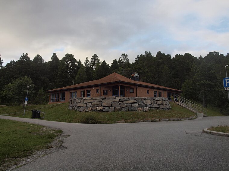
Photo: Løken, CC BY-SA 3.0.
Nordbyen Church is a parish church of the Church of Norway in Molde Municipality in Møre og Romsdal county, Norway. It is located in the Nordbyen area of the town of Molde. Nordbyen Church is situated 3½ km west of Årøhuken.
Kviltorp skole
School

Photo: PeterFisk, CC BY-SA 3.0.
Kviltorp skole is a school, which is situated 3½ km southwest of Årøhuken.
Årøhuken
- Type: Shelter
- Categories: building and hut
- Location: Molde, Møre og Romsdal, Western Norway, Norway, Nordic countries, Europe
- View on OpenStreetMap
Latitude
62.76021° or 62° 45′ 37″ northLongitude
7.29091° or 7° 17′ 27″ eastOpen location code
9FJ9Q76R+39OpenStreetMap ID
way 728815872OpenStreetMap feature
amenity=shelterOpenStreetMap feature
building=hut
This page is based on OpenStreetMap, Wikidata, and Wikimedia Commons.
We’d love your help improving our open data sources. Thank you for contributing.
Satellite Map
Discover Årøhuken from above in high-definition satellite imagery.
Notable Places Nearby
Highlights include Røbekk gravlund and Sølvdammen.
Nearby Places
Explore places such as Årølia skole and Årølia skole.
Møre og Romsdal: Must-Visit Destinations
Delve into Ålesund, Kristiansund, Averøy, and Geiranger.
Curious Shelters to Discover
Uncover intriguing shelters from every corner of the globe.
About Mapcarta. Data © OpenStreetMap contributors and available under the Open Database License". Text is available under the CC BY-SA 4.0 license, except for photos, directions, and the map. Photo: Molde20, CC BY-SA 3.0.