Hare Tarn Farm
Hare Tarn Farm is a farm in United Kingdom. Hare Tarn Farm is situated nearby to the motorhome stopover Northside Caravan Park, as well as near Pastordale Farm Caravan Site.| Tap on a place to explore it |
Places of Interest Nearby
Highlights include Capernwray Dive Centre and Capernwray Viaduct.
Capernwray Dive Centre

Photo: Karl and Ali, CC BY-SA 2.0.
Capernwray Dive Centre is a large flooded former quarry, presently operated as an inland scuba diving site and training centre, near the village of Over Kellet, Lancashire, England. Capernwray Dive Centre is situated 3,800 feet east of Hare Tarn Farm.
Capernwray Viaduct
Bridge

Photo: Don Burgess, CC BY-SA 2.0.
Capernwray Viaduct is a bridge, which is situated 4,200 feet east of Hare Tarn Farm.
St Oswald’s Church
Church
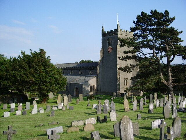
Photo: Alexander P Kapp, CC BY-SA 2.0.
St Oswald's Church is in the village of Warton, Lancashire, England. It is an active Anglican parish church in the deanery of Tunstall, the archdeaconry of Lancaster, and the diocese of Blackburn. St Oswald’s Church is situated 1¼ miles northwest of Hare Tarn Farm.
Places in the Area
Nearby places include Borwick and Carnforth.
Borwick
Village

Photo: Alexander P Kapp, CC BY-SA 2.0.
Borwick is a village and civil parish in the City of Lancaster district of Lancashire, England, about 8 miles north of Lancaster, on the Lancaster Canal.
Carnforth

Photo: Jay Son, CC BY-SA 3.0.
Carnforth is a small market town in Lancashire in Northwest England. It's best known for its railway station, location for the 1945 David Lean film Brief Encounter, with the station clock ticking relentlessly to trammel the characters' lives.
Priest Hutton
Village

Photo: David Medcalf, CC BY-SA 2.0.
Priest Hutton is a village and civil parish in Lancashire, England. It is located 5 kilometres north east of Carnforth, in the City of Lancaster, close to the boundary with Cumbria. Priest Hutton is situated 1½ miles northeast of Hare Tarn Farm.
Hare Tarn Farm
- Type: Farm
- Address: Carnforth, LA6 1AA
- Category: agriculture
- Location: United Kingdom, Britain and Ireland, Europe
- View on OpenStreetMap
Latitude
54.13699° or 54° 8′ 13″ northLongitude
-2.74176° or 2° 44′ 30″ westOpen location code
9C6V47P5+Q7OpenStreetMap ID
way 738278418OpenStreetMap feature
landuse=farmyard
This page is based on OpenStreetMap, Wikidata, and Wikimedia Commons.
We’d love your help improving our open data sources. Thank you for contributing.
Satellite Map
Discover Hare Tarn Farm from above in high-definition satellite imagery.
Notable Places Nearby
Highlights include Northside Caravan Park and Pastordale Farm Caravan Site.
Nearby Places
Explore places such as Pastordale Farm and Kellet Bridge Farm.
United Kingdom: Must-Visit Destinations
Delve into London, Edinburgh, England, and Manchester.
Curious Farms to Discover
Uncover intriguing farms from every corner of the globe.
About Mapcarta. Data © OpenStreetMap contributors and available under the Open Database License". Text is available under the CC BY-SA 4.0 license, except for photos, directions, and the map. Photo: Tomorrow Never Knows, CC BY 2.0.