Église Protestante Unie de Belgique
Église Protestante Unie de Belgique is a church in Wavre, Arrondissement of Nivelles, Wallonia which is located on Avenue de la Belle Voie. Église Protestante Unie de Belgique is situated nearby to the pitch Racing Jet Wavre, as well as near the community center CSD BRABANT WALLON.| Tap on a place to explore it |
- Type: Church
- Denomination: Protestant
- Address: Avenue de la Belle Voie 15
Places of Interest Nearby
Highlights include Église Saint-Jean-Baptiste de Wavre and City hall of Wavre.
Église Saint-Jean-Baptiste de Wavre
Church
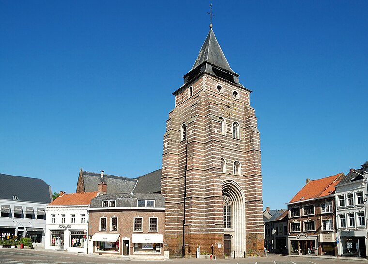
Photo: EmDee, CC BY-SA 3.0.
Église Saint-Jean-Baptiste de Wavre is a church, which is situated 490 metres southwest of Église Protestante Unie de Belgique.
City hall of Wavre
Town hall

Photo: EmDee, CC BY-SA 3.0.
City hall of Wavre is a town hall, which is situated 740 metres southwest of Église Protestante Unie de Belgique.
Basilique Notre-Dame de Basse-Wavre
Church

Photo: GVR, CC BY-SA 3.0.
Basilique Notre-Dame de Basse-Wavre is a church, which is situated 760 metres northeast of Église Protestante Unie de Belgique.
Places in the Area
Nearby places include Ottenburg and Rosières.
Ottenburg
Village

Photo: Wouterhagens, Public domain.
Ottenburg is a village in the municipality of Huldenberg in the province of Flemish Brabant, Belgium, close to the language border. The prehistoric earthwork, a long barrow known as de Tomme, is located here, identified in 2021 by archaeologists as the oldest such monument known in the Low Countries. Ottenburg is situated 3½ km north of Église Protestante Unie de Belgique.
Rosières
Village

Photo: Djozewal, CC BY-SA 4.0.
Rosières is a village, which is situated 5 km west of Église Protestante Unie de Belgique.
Archennes
Village

Photo: Wouterhagens, CC BY-SA 3.0.
Archennes is a village, which is situated 5 km northeast of Église Protestante Unie de Belgique.
Église Protestante Unie de Belgique
- Categories: house, building, place of worship, and religion
- Location: Wavre, Arrondissement of Nivelles, Walloon Brabant, Wallonia, Belgium, Benelux, Europe
- View on OpenStreetMap
Latitude
50.71928° or 50° 43′ 9″ northLongitude
4.61712° or 4° 37′ 2″ eastOpen location code
9F26PJ98+PROpenStreetMap ID
way 741151301OpenStreetMap feature
amenity=place_of_worshipOpenStreetMap feature
building=houseOpenStreetMap attribute
denomination=protestant
This page is based on OpenStreetMap, Wikidata, and Wikimedia Commons.
We’d love your help improving our open data sources. Thank you for contributing.
Satellite Map
Discover Église Protestante Unie de Belgique from above in high-definition satellite imagery.
Places with the Same Name
Discover other places named “Église Protestante Unie de Belgique”.
Notable Places Nearby
Highlights include Racing Jet Wavre and CSD BRABANT WALLON.
Nearby Places
Explore places such as Parking Désiré Yernaux and Martine David.
Walloon Brabant: Must-Visit Destinations
Delve into Waterloo, Villers-la-Ville, and Louvain-la-Neuve.
Curious Churches to Discover
Uncover intriguing churches from every corner of the globe.
About Mapcarta. Data © OpenStreetMap contributors and available under the Open Database License". Text is available under the CC BY-SA 4.0 license, except for photos, directions, and the map. Photo: Myrabella, CC BY-SA 3.0.